Can you conquer 40 staircases in Silver Lake?
- Share via
By Mary Forgione
Welcome to The Wild! (View in web browser here.)
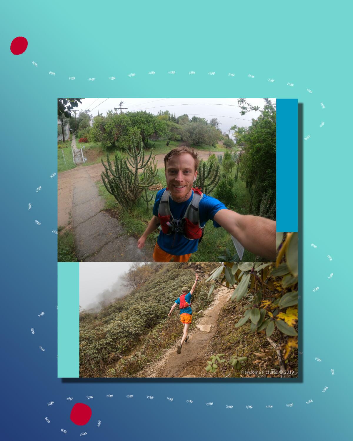
Need a challenging new neighborhood route in L.A.? Head to Silver Lake for this tough 16-mile walking/running route that includes 40 historic staircases. And it counts only if you go up the stairs. Cameron Kruse, 31, created the route (and the rules) because he was looking for close-to-home adventures to get him through the pandemic.
His quests usually take him to rock faces to climb, or the Himalayas, where he photographs and works on digital storytelling, something he calls “scrollytelling.” “My day job is a creative technologist. I figure out ways to tell stories with technology, but I moonlight as a National Geographic explorer,” the rock climber and runner said.
But back to the route. Kruse first identified all the stairs he wanted to include on his route, then sketched in the boundaries of Silver Lake and pieced together a street route using a storytelling template in Mapbox, a free tool that’s been around since 2010. The template allowed him to share photos and text so users can see what’s along the route. “You’re using digital technology to push people’s attention through the actual world, not distracting them from it,” he said.
More rules: Skip closed staircases, stay off private ones. The route begins around Micheltorena Street near Sunset Boulevard (near where Kruse lives). The first staircase climbs up from Hamilton Way to Murray Drive. The route is big and a little loopy to accommodate the stairs, and enclosed by the neighborhood bordered on the north and south by freeways (the 5 and 101, respectively), Hoover Street on the east and Benton Way on the west. It took Kruse 4:08:42 to run the 16.86 miles with 4,040 feet of gain. (He thinks he can improve on that time.)
My advice: Preview the route here, then break it into segments or do it all at once. Walk with friends or run it with your favorite playlist. It’s a great way to discover sweet spots in Silver Lake — and get a good workout. The route also will appear on the FKT (Fastest Known Time) website.
4 things to do this week

1. Snap photos of bugs, plants, fungi and wildlife for the City Nature Challenge. What’s the best way to document what’s happening in Southern California’s wild habitat? Start by asking Angelenos to snap a photo of what they see and where during the 2021 City Nature Challenge, Friday through Monday. Sorry, your pet macaw, golden retriever or backyard garden filled with exotic species doesn’t qualify. Look for wild things that belong in the landscape such as lizards, beetles, birds, seals, dolphins — you get the idea. Here’s how to help: Take pictures anywhere in L.A. County and upload them on the free mobile app iNaturalist. You must create a profile in advance and then upload photos (the app will guide you on what information to capture: where you saw it, when, etc.). Last year’s challenge inspired 41,000 people to join, according to the Natural History Museum of L.A. County, which pioneered the event in 2016 with the California Academy of Sciences in San Francisco. From May 4 to 9, you can also help identify what species were found. Here are details on how to get started.

2. Go roller skating on a pop-up rink with retro tunes and ocean views. You can skate on streets just about anywhere in Southern California, but the temporary outdoor rink coming to the Paséa Hotel & Spa in Huntington Beach adds music to the mix. Skate nights start with the sound of Selena for Cinco de Mayo (May 5) and continue with disco nights, boy bands of the ’90s (May 11), Donna Summer tribute (May 13) and other throwback themes. The 90-minute sessions cost $22 if you bring your own skates, $25 with skate rentals. It is open noon to 10 p.m. May 4-19; masks and social distancing required. Tickets must be purchased in advance. More info here.
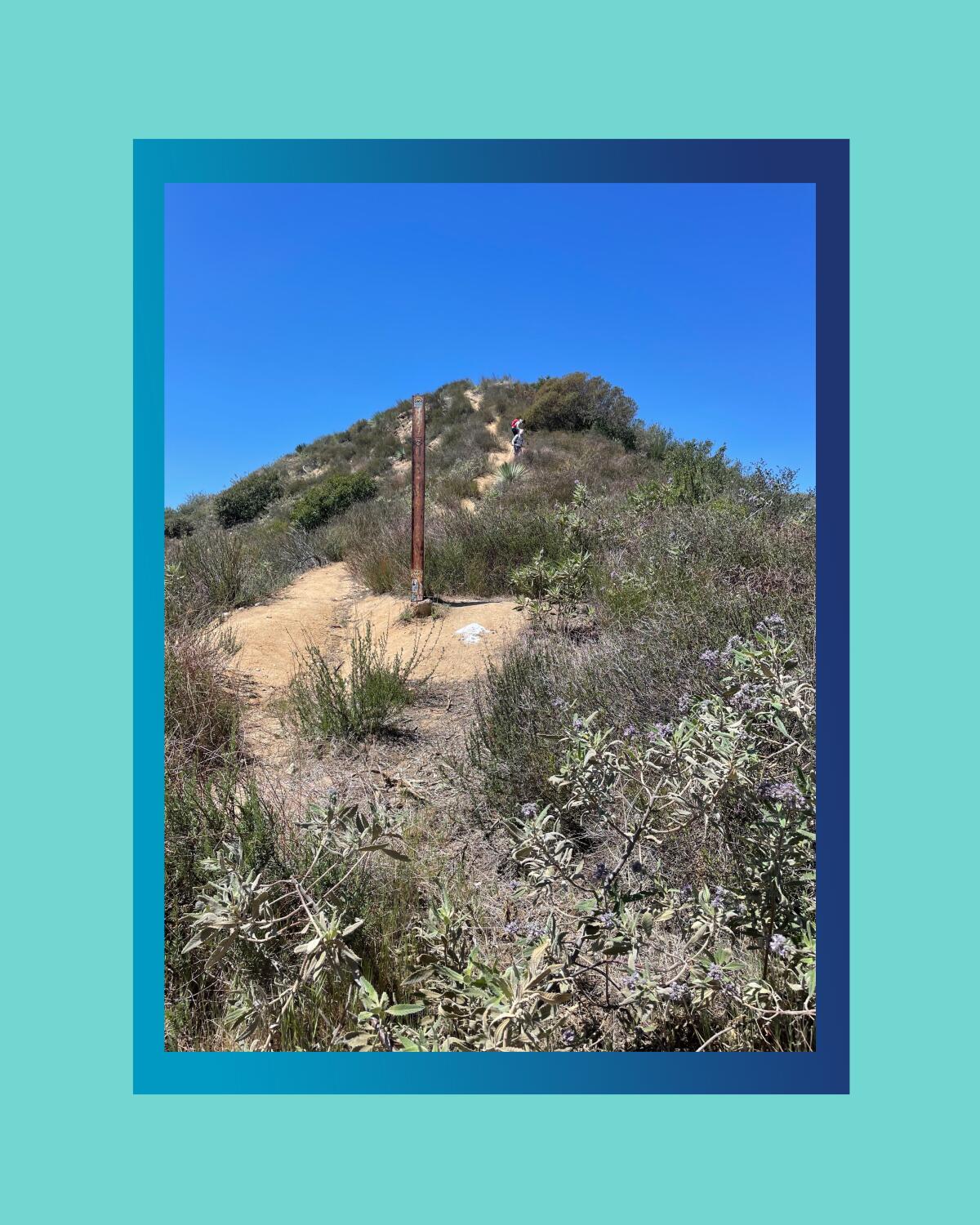
3. Take a hike to Wella’s Peak in the Angeles National Forest. Where the heck is Wella’s Peak? I’d always wondered about that until I realized I was standing on top of it. There’s no sign (though online hiker photos show smiling people hoisting a wooden sign) so you must check your trail app to learn that you made it to the almost 3,000-foot summit. I followed an AllTrails route that started steeply down for a half mile from the Angeles Crest Station on California 2, skirted the waterfalls at Paul Little Picnic Area and crossed the wide arroyo (easy to get off trail in this area) before joining the Ken Burton Trail and heading to the top. You must follow an overgrown goat trail and walk uphill until you are at a high point. That’s it; you’re there. Here’s the 7.8-mile route I followed (my tracker measured about a mile more) with 2,316 feet of gain. Let me know if you find the peak!
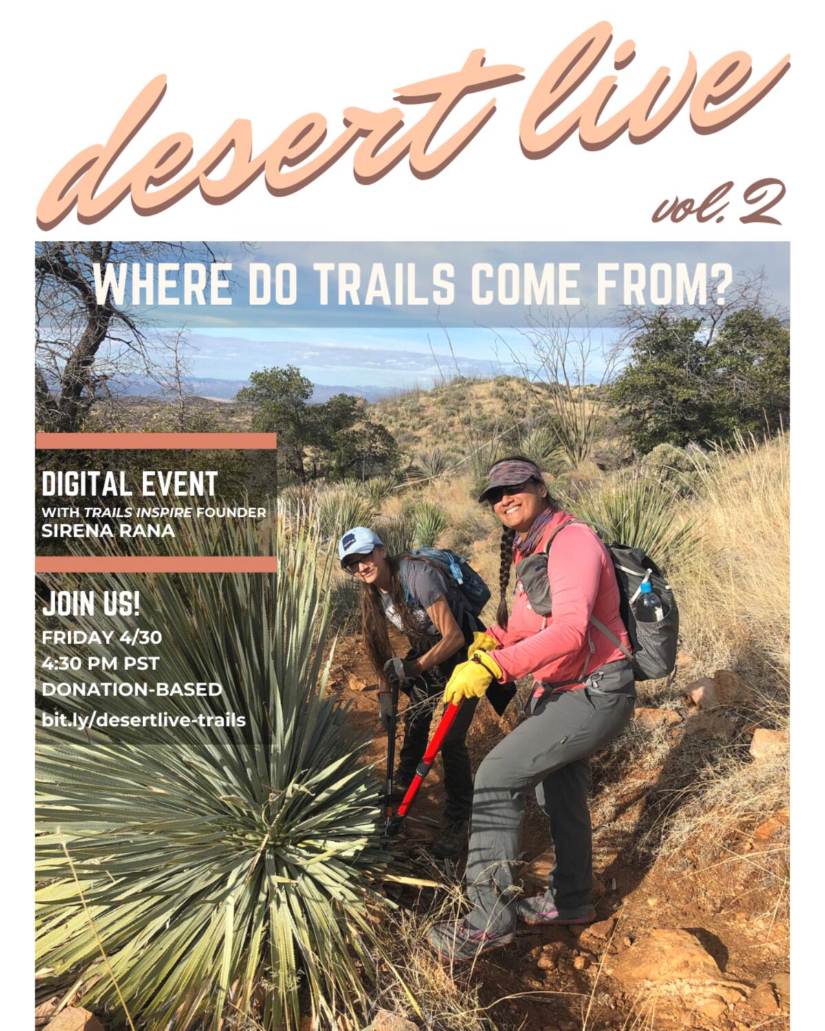
4. How are trails built? Join an online talk with trail designer Sirena Rana. Trails once were created when enough people tramped on a path through a field, up a mountain or across a plain. These days hiking trails require more thought and design, with people in mind. Sirena Rana of Trails Inspire will discuss how trails are conceptualized, designed, built and maintained — and what it takes to construct a new route. The talk, sponsored by the Desert Institute at Joshua Tree National Park, takes place online at 4:30 p.m. April 30 (contribution of $5 or more recommended). Click here to save a spot.
The red flag
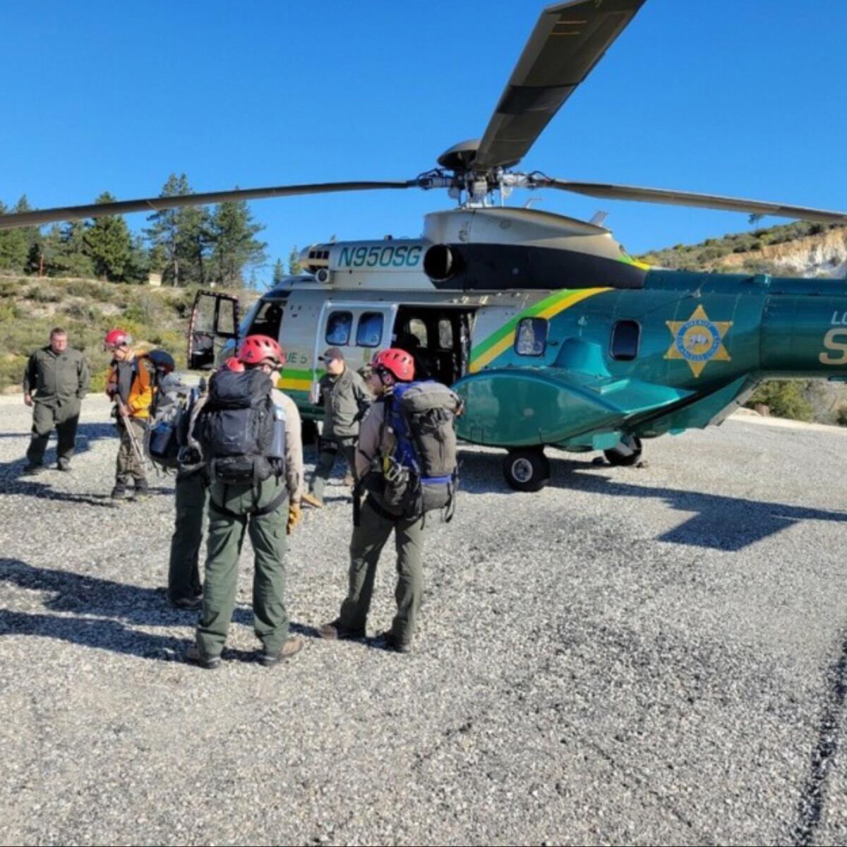
Let’s file this under lessons learned the hard way. Rene Compean, 45, of Palmdale, was rescued last week after getting lost and spending the night in a remote part of the Angeles National Forest. What’s remarkable is how he was found: The Sheriff’s Department released a grainy photo of his legs hanging above a rocky landscape that he had sent to a friend. Ben Kuo of Thousand Oaks, an avid hiker who knows the forest, worked out where Compean might be by matching satellite images of the vegetation and terrain to the photo. Kuo sent the GPS coordinates to authorities, and they located Compean, who had no major injuries, within three-quarters of a mile of the spot.
But that’s not the end of the story. Compean was found in an area near Triplet Rocks and Twin Peaks not far from Mt. Waterman, deep in the off-limits burn area of the Bobcat fire. Extensive parts of the forest have been closed since last summer. Entering a fire closure zone is a misdemeanor that can result in up to six months in jail and up to a $10,000 fine, authorities say. Whether Compean will be charged isn’t clear. Capt. Russ Tuttle, chief of law enforcement for the national forest, told The Times that it’s a “tough call” because of what the lost hiker experienced. Read more about the rescue and the potential consequences of hiking in closed areas.
Wild things
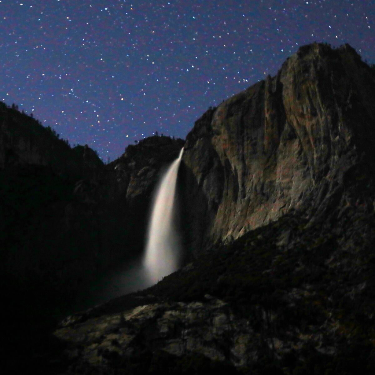
In March 2020, Yosemite National Park closed because of the coronavirus. Some staff remained but wildlife had the run of the park without tourists. Now visitors have returned to sing and play tunes around the campfire, jump into the chilly Merced River, climb El Capitan, hike the Mist Trail to Vernal Falls and marvel at waterfalls that churn most powerfully in spring. If you’re a kid, it’s an ideal time to swing in a hammock at your campsite. And the animals? Coyote, bobcat and Steller’s jay thrive, dogwood is blooming, and the night sky still offers a stellar light show. Here’s what Yosemite looks like a year after the animals took over.
If you go, remember that even day-use visitors need reservations to enter the park starting May 21 and continuing through Sept. 30. Yosemite will allow half the average number of vehicles that usually visit in peak months. For June, that number is 3,600 vehicles each day. Here’s the schedule for release of day-use permits and how to get one.
The must-read
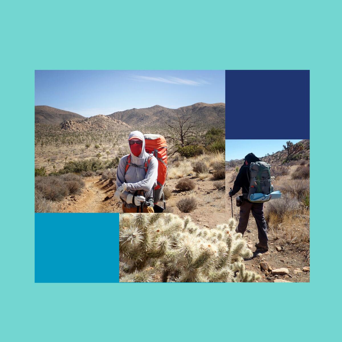
I love the desert, especially the routes in Joshua Tree and Death Valley national parks profiled in our 50 best hikes in L.A. guide. But desert hiking requires extra preparation to stay safe. “SoCal deserts provide a bona fide playground for the prepared hiker,” Regge Bulman writes on the Sierra Club’s Angeles Chapter’s website. “What the desert does not provide is a gentle experience for the unprepared.” OK, that’s a little scary. Regge, a trained Sierra Club leader and assistant group leader of the club’s Wilderness Travel Course, breaks down what you need to wear, carry and know before you set out. Wear shorts and a tank top to beat the heat? Not unless you want to be poked by cactus or wither in the sun. Check out his tips in “Desert Hiking 101: How to Be Prepared.”
P.S.

You weren’t hallucinating if you saw a person in a cute bear suit walking from L.A. to San Francisco. It was Jesse Larios, 33, of Los Angeles, who started April 12 and walked more than 400 miles to the Bay Area. He finished Saturday, raising $17,000 to donate to the National Alliance on Mental Illness. Next up: a walk to New York. Why the bear suit? No real reason, according to media accounts, but what could be better to stop along the way and make friends? You can follow him on Instagram @iambearsun.

Want something new to wear on the trail this summer? Add a white, sun-reflecting bucket hat with The Wild logo to your hiking wardrobe. You can pick up a branded water bottle too. Click here to order.
Send us your thoughts
Share anything that’s on your mind. The Wild is written for you and delivered to your inbox for free. Drop us a line at [email protected].
Click to view the web version of this newsletter and share it with others, and sign up to have it sent weekly to your inbox. I’m Mary Forgione, and I write The Wild. I’ve been exploring trails and open spaces in Southern California for four decades.

Sign up for The Wild
We’ll help you find the best places to hike, bike and run, as well as the perfect silent spots for meditation and yoga.
You may occasionally receive promotional content from the Los Angeles Times.


