‘There are bodies everywhere’: In devastation of Maui fire, California’s past horrors lurk
- Share via
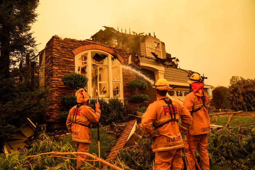
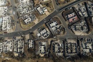
As horrifying details emerge about the fire that burned through Maui, the tragedy echoes the extreme fire behavior and the failed human response to it that have haunted California over the last few decades.
Emergency alert systems that crumple when needed most.
Limited escape routes, leaving some to die in their vehicles trying to flee or sheltered in their homes as flames sweep through.
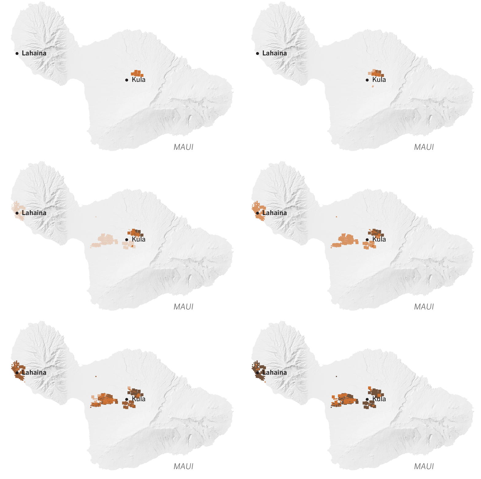
The Lahaina fire in West Maui ignited as firefighters focused on the Upcountry fire. What happened next — the deadliest U.S. wildfire in more than a century — left the historic town in ashes.
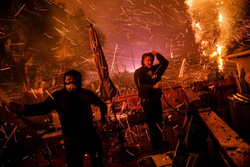
Impossibly fast winds that send showers of embers leaping from burned home to home, destroying whole blocks in a flash.
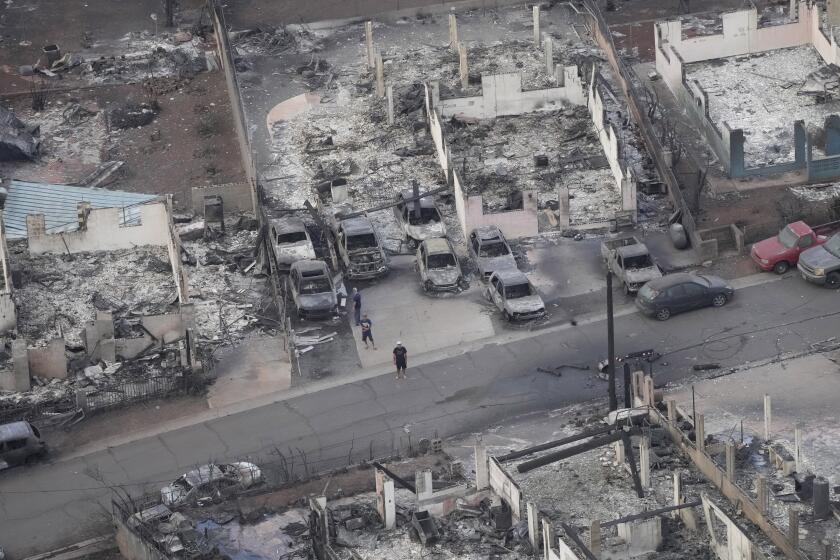
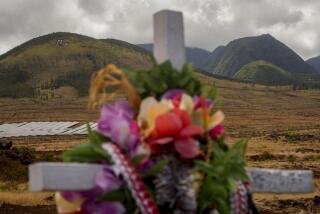
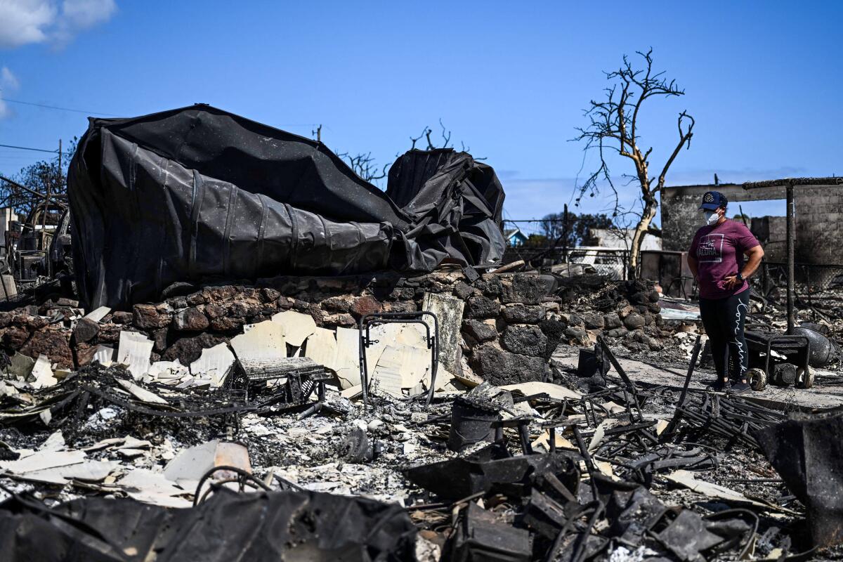
Unimaginable damage not just to neighborhoods but an entire city, obliterating homes for multi-generational families. Children, parents and grandparents are among the dead. The death toll now stands at more than 90, making it the deadliest wildfire in the U.S. in the last century, surpassing the 2018 Camp fire that destroyed the Northern California town of Paradise, where at least 85 died.
“It’s almost like Pompeii, where it was like partners holding each other and parents huddled around children,” Brittany Harris, 37, a Kahului resident, said a friend told her. “It happened very quickly that everything exploded ... cars, buildings, everything was on fire.”
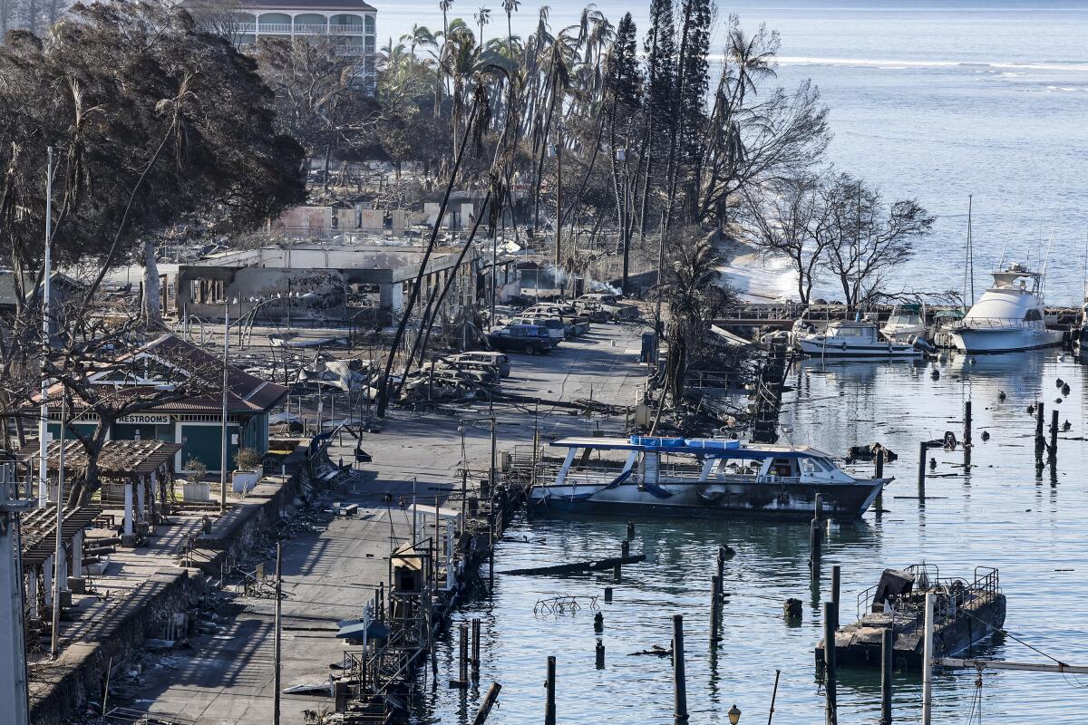
The fire arrived with such fury that even the ocean couldn’t offer refuge. Initial reports suggested as many as 100 people sought safety in the water amid flying embers and falling ash, as parents struggled to keep children from being pulled away to sea.
“They jumped in the ocean to escape that, but then there were still people dying of smoke inhalation in the ocean,” Harris said. “My friend, whose husband is a police officer, said there are bodies everywhere, there are bodies in trees.”
Sefo Rosenthal, 37, who has lived on Maui most of his life, said he was furious with the lack of preparation and communication.
“Was there enough warning? I don’t think so. If you have to jump into the water, that’s not enough warning,” he said.
As Hawaii begins to tally the damage and assess how to improve its safety procedures to address extreme fire weather, California can offer many lessons.
A series of deadly natural disasters — historic fires in Paradise, Malibu and wine country and landslides in Santa Barbara County — exposed major weaknesses in local, state and federal emergency responses and outmoded evacuation and alerting procedures.
California responded with sweeping changes, including improved emergency communications, automatic power line shut-offs during windy conditions and more robust warnings of forecasts.
After Northern California officials were criticized in 2017 for issuing few broad warnings of fire weather ahead of what became historic deadly wildfires, state officials took action when fire weather came to the south: issuing unprecedented cellphone warnings to some 12 million residents in seven Southern California counties.
Those warnings came quite early, and residents said the early alerts kept them vigilant and on alert to watch for evacuation orders. State officials considered the broad alerts a success.
A long-term solution would be to put power transmission lines underground, reducing the risk of high winds igniting a fire. But a shorter-term solution is preemptively shutting down of the electrical grid during times of high fire danger.
They can cause problems, such as cutting off power to medically needy residents, and limiting residents’ ability to monitor evacuation notices should danger come near. Still, recently Pacific Gas & Electric Co. noted an 80% reduction in ignitions in high wildfire-threat areas reported to the state.
A common problem found in some of the worst disasters was, in hindsight, seemingly inexplicable reluctance to issue clear evacuation orders early, or even send alerts through tools such as text messages.
In early 2018, officials in Santa Barbara County released conflicting evacuation instructions in the days before deadly landslides struck Montecito, resulting in more than 20 deaths. Officials eventually sent an Amber Alert-style bulletin to cellphones — but only after the landslides had begun.
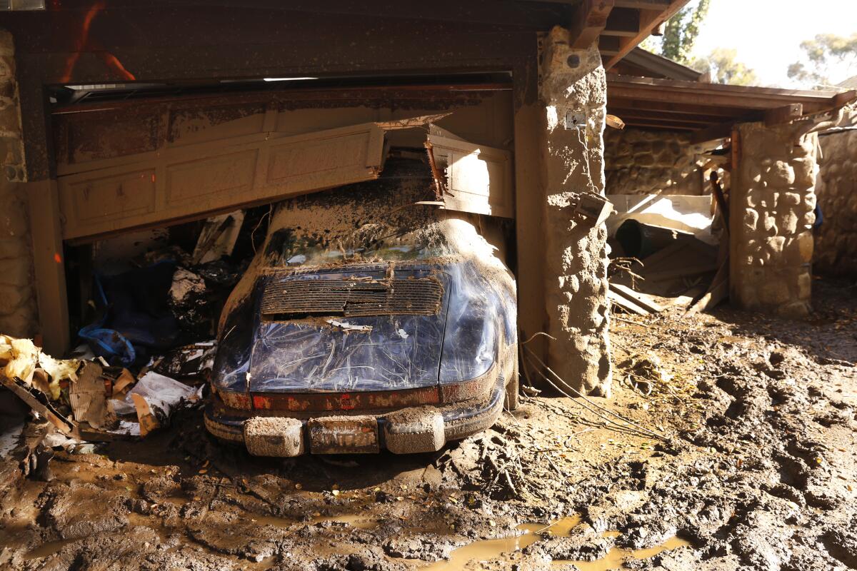
Officials have since become increasingly assertive with warnings. In 2019, for example, the National Weather Service office in Oxnard issued an unprecedented “extreme red flag” warning of dangerous fire weather, with forecast gusts of up 80 mph expected, which meteorologists said they can’t remember ever using. But the tactic seemed to work in getting people’s attention in ways that they might have previously tuned out a “typical” red flag warning.
Hawaii is now facing many of the same questions about the Maui fires, and California can be a place to look for solutions.
“We have strong winds. We have topography. And we have [human] settlement immediately adjacent to vegetation,” UC Merced climatologist John Abatzoglou said.
And with winds come loss of power and communications, something that hit the historic West Maui town of Lahaina — once the royal residence of the Hawaiian king — before the danger of the fire had become clear. Even several days after the fire, much of the west side of Maui remained without internet, power and water, although officials said some cellphone service was available.
“What a lot of people forget is that, in some of the events that we’ve seen in California, cell towers go out very quickly, either because they lose power or they’re burned up,” said Crystal Kolden, a professor of fire science at UC Merced.
Until Tuesday, Maui has avoided the kind of death and destruction California has seen from such severe fire weather. That luck ran out amid decades of increasing housing development, the spread of flammable nonnative grasses that have taken over abandoned farms and ranches, a local emergency response system that remains vulnerable to power failures, and decisions to not order evacuations earlier.
Wildfires on the Hawaiian island of Maui have killed at least 36 people, displaced thousands of residents and destroyed hundreds of structures, including homes, businesses and a school, prompting President Biden to declare a “major disaster.”
Maui has had fire weather before, and this week’s bout has been seen before — a distant hurricane to the island’s south, bringing low pressure there, while an area of high pressure exists to the north.
That’s a recipe for the kind of downslope winds that are so familiar to California that each region seems to have a local name for them: Santa Ana winds in Southern California, Diablo winds in the San Francisco Bay Area, sundowner winds in Santa Barbara, Jarbo Gap winds in the Sacramento Valley and Mono winds in the San Joaquin Valley.
They even all generally move in a similar direction, from the northeast to the southwest, or in the case of sundowner winds, from north to south.
These downslope winds have been a hallmark of California’s deadliest wildfires, owing to the ferocity of the winds that can spread a blizzard of embers hopscotching across tinder-dry vegetation. Nothing can be done about these winds, but officials can sound the alarm in ways to get members of the public to take warnings about fire weather seriously, and, if living in a fire-prone area, know the evacuation routes and be ready to leave.
One question investigators will probably ask is why local officials did not order widespread evacuations once a fire had been reported in one of the highest neighborhoods in Lahaina. Developed in the 1980s, the neighborhood was built at the base of canyons that can be buffeted by howling Santa Ana-style winds, creating a situation that should homes ignite, an urban conflagration could begin and take a path with nowhere else to go but downhill, striking at the heart of the historic downtown.
Questions will also arise about whether local officials thought about how they might try to empty out Lahaina in a crisis, given that there are only two exits out of town: a narrow mountainous road to the north that ended up being closed during the disaster, and a path to the south that was closed for at least part of the peak disaster time period because of falling power poles.
At one point Tuesday night, officials were even forced to evacuate the local evacuation site.
There are substantial similarities with the Camp fire, which reduced Paradise in Butte County to ashes.
A Times investigation found that officials in Paradise were ill-equipped for such a conflagration. In the same way that Maui County’s hazard mitigation plan had warned of fire risks, California fire management officials once warned about severe winds posing a serious threat to Paradise, but town officials repeatedly told The Times they never envisioned a firestorm of that scale reaching the town.
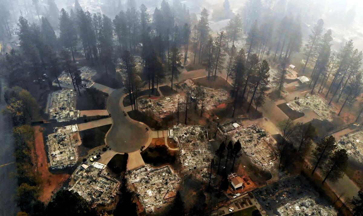
The Times also found that Paradise had no plan to evacuate the entire town simultaneously, entrusted public alerts to a system vulnerable to fire and did not sound citywide orders to flee even as a hail of fire rained down. And as in Lahaina, Paradise suffered from limited escape routes.
And in an echo of Lahaina, Paradise showed how once homes start burning, the threat escalates exponentially for the rest of the town. Fires that spread from house to house generate a force of their own, sending up billions of embers that ignite one structure after another, continuing block after block.
In 2017, a series of fires across Northern California resulted in 44 deaths, with 22 from the Tubbs fire that burned through Sonoma and Napa counties. In some of those fires, some residents learned of the fire’s danger only when they saw flames outside their window and it was too late to escape. Others were so surprised by the fire they jumped into swimming pools or water tanks or ran through vineyards.
Ahead of those fires, weather forecasters had told fire departments across Northern California to prepare for incendiary conditions. But decisions to broadcast evacuation orders did not take place until hours after the fires started and residents were already trapped.
Officials were criticized for failing to push out warnings to cellphones through the Wireless Emergency Alerts system.
Since then, emergency managers in parts of California have gone from being reluctant to order widespread evacuations to sending out an abundance of emergency information while telecommunications still work.
And organization helps: In one example, Sonoma County had already identified senior care living facilities full of vulnerable residents, so when an evacuation order came, shuttle buses sent from the city of Santa Rosa were already ready to help get residents out.
Three years after its disastrous response to the Tubbs fire, Sonoma County officials say they have found a better approach.
Another key question that officials will probably look at is whether firefighters did enough to watch over the Lahaina fire in its early hours. The initial report of the fire came in at 6:37 a.m., but by around 10 a.m., authorities announced that it had been “100% contained,” only for a hot spot to flare up that afternoon in what would become one of Hawaii’s deadliest natural disasters in modern history.
In the Oakland Hills fire of 1991, firefighters thought that they had extinguished a brush fire a day before a hot spot flared up amid Diablo winds. The resulting fast-moving fire claimed 25 lives, making it the third deadliest in California history. Some died in their cars, unable to escape the flames as narrow exit roads were jammed.
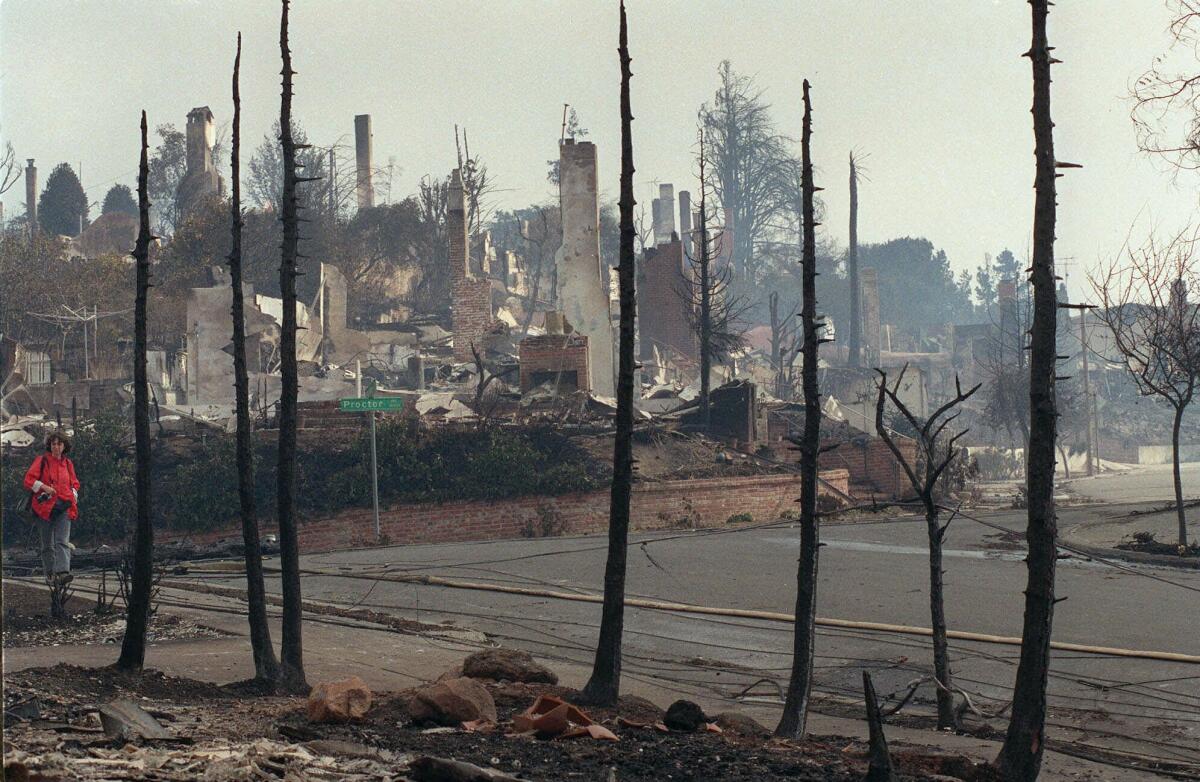
The fact that Maui firefighters were also having to fight other fires far east of Lahaina probably strained resources. Maui County Fire Chief Brad Ventura at a news conference spoke of firefighting resources having to be triaged Tuesday to “what was most important at the time.”
Those factors complicated the effort to battle the 2018 Woolsey fire in Los Angeles County, which became one of the worst ever to hit Malibu. Firefighting resources were focused on another blaze, the Hill fire, and it would be hours before an all-out attack would be directed on the Woolsey fire, according to a Times review of public records and radio transmission, which would become one of the most destructive fires in Los Angeles and Ventura county history.
Firefighters can also bungle efforts to hit the fire early. A Times investigation of the 2009 Station fire in L.A. County, which killed two firefighters and was the largest in county history, found that U.S. Forest Service officials underestimated the threat posed by the fire and scaled back their attack the night before it began to rage out of control.
A federal inquiry concluded the Forest Service failed to use all resources that might have been available during the critical early hours of that fire.
The role of housing developments encroaching ever closer to wildlands could also come under review. Some of the homes closest to where the Lahaina fire began were built in the 1980s — relatively new given the centuries of history of the town.
In part because of concerns about building in areas at high risk of wildfire, a Los Angeles County Superior Court judge in 2021 in effect blocked a proposed housing development on the southern flanks of the Tehachapi Mountains, about 70 miles north of Los Angeles. The ruling did not kill the project but threatened to delay it significantly.
Lin reported from San Francisco and Dolan and Gauthier from Maui. Times staff writers Alexandra E. Petri, Richard Winton, Paige St. John, Joseph Serna, Jaclyn Cosgrove, Louis Sahagún, Paul Pringle and Thomas Curwen contributed to this report.
More to Read
Sign up for Essential California
The most important California stories and recommendations in your inbox every morning.
You may occasionally receive promotional content from the Los Angeles Times.
