3 excellent Mt. Wilson hikes to explore L.A.’s rich space history
- Share via
I grew up in a rural place with minimal light pollution. When I looked up to the night sky, I could see layers of stars and, on a moonless night, the Milky Way. And I wondered who else was up there, living on one of those twinkling planets my older brother taught me how to spot.
Really seeing the stars makes me feel connected to far more than what’s on the third rock from the sun. Perhaps that’s why I feel such a sense of wonder, pride and connection with NASA’s upcoming Europa Clipper mission, set to launch soon from the Kennedy Space Center in Florida. And why, over the past few weeks, I’ve wanted to learn more about L.A.’s own history with space exploration.
You are reading The Wild newsletter
Sign up to get expert tips on the best of Southern California's beaches, trails, parks, deserts, forests and mountains in your inbox every Thursday
You may occasionally receive promotional content from the Los Angeles Times.
The Europa Clipper’s mission is to determine whether Europa, Jupiter’s icy moon that might have twice the amount of water as Earth, has “habitable conditions,” which does not mean scientists are looking for a second home for humans but instead trying to discern if life could be supported in Europa’s massive saltwater ocean. (Its launch was postponed from today because of Hurricane Milton and will be rescheduled after the storm passes.)
Jupiter has 95 “officially recognized” moons, but scientists have focused much attention on its four largest: Io, a funky green moon covered in volcanoes (which are so powerful they can sometimes be seen from a large telescope on Earth); Ganymede, the largest moon in our solar system; Callisto, which scientists previously thought was “a dead, inactive rocky body” (rude); and our girl Europa.
Why should we care about some far-off planet’s moons? Serina Diniega, an investigation scientist on the Europa Clipper mission at NASA’s Jet Propulsion Lab in La Cañada Flintridgecirrectuib, says that this mission seeks to ask big questions about the universe: Could life have developed on Europa? If so, in what form?
For the record:
4:46 p.m. Oct. 15, 2024A previous version of this story said that NASA’s Jet Propulsion Lab is in Pasadena. It is in La Cañada Flintridge.
“We want to understand our place in the solar system, we as in humans, we as in [those] on the Earth, within this myriad of a really beautiful range of worlds that are out there, of which Europa is definitely kind of an extreme example,” Diniega said.
Europa provides scientists with the best opportunity — albeit via a journey that will take six years to reach — to study a place where life could exist. On a much broader level, it reminds us of how it feels to wonder and explore. And it underscores the reason so many of us find ourselves looking up at the night sky, imagining what mysteries remain in our universe.
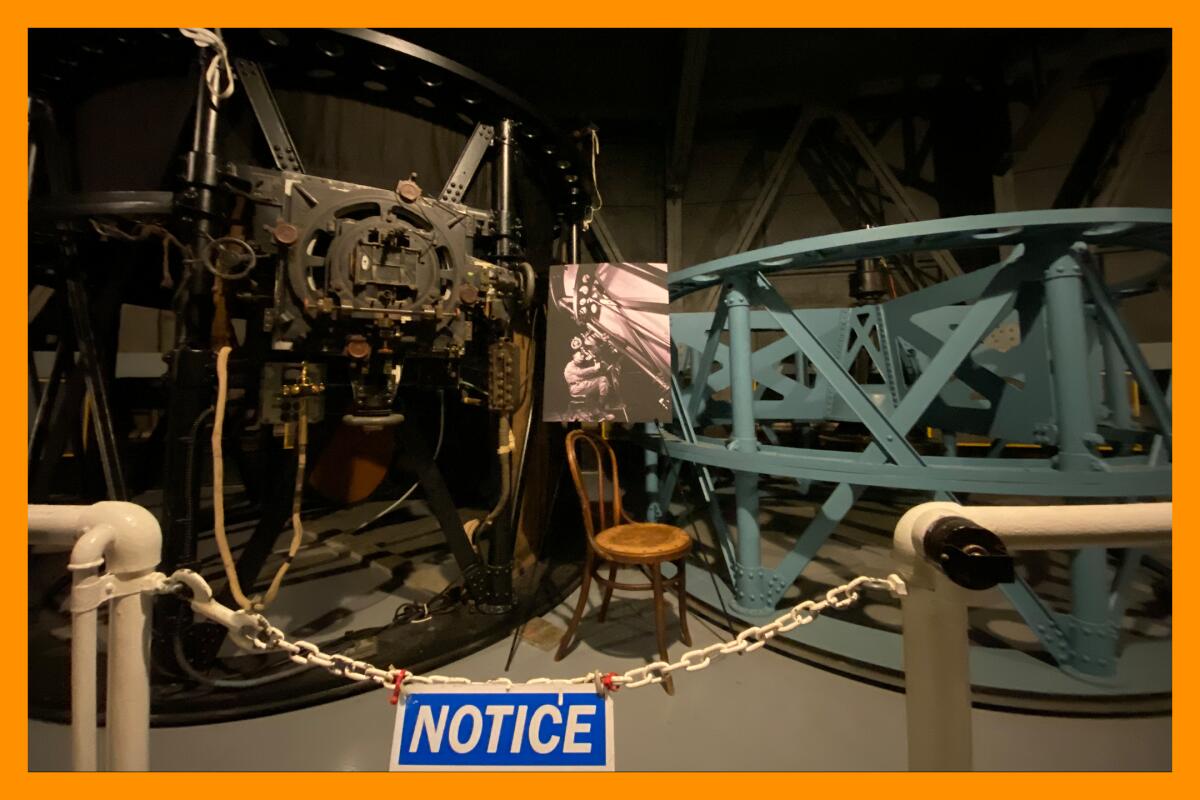
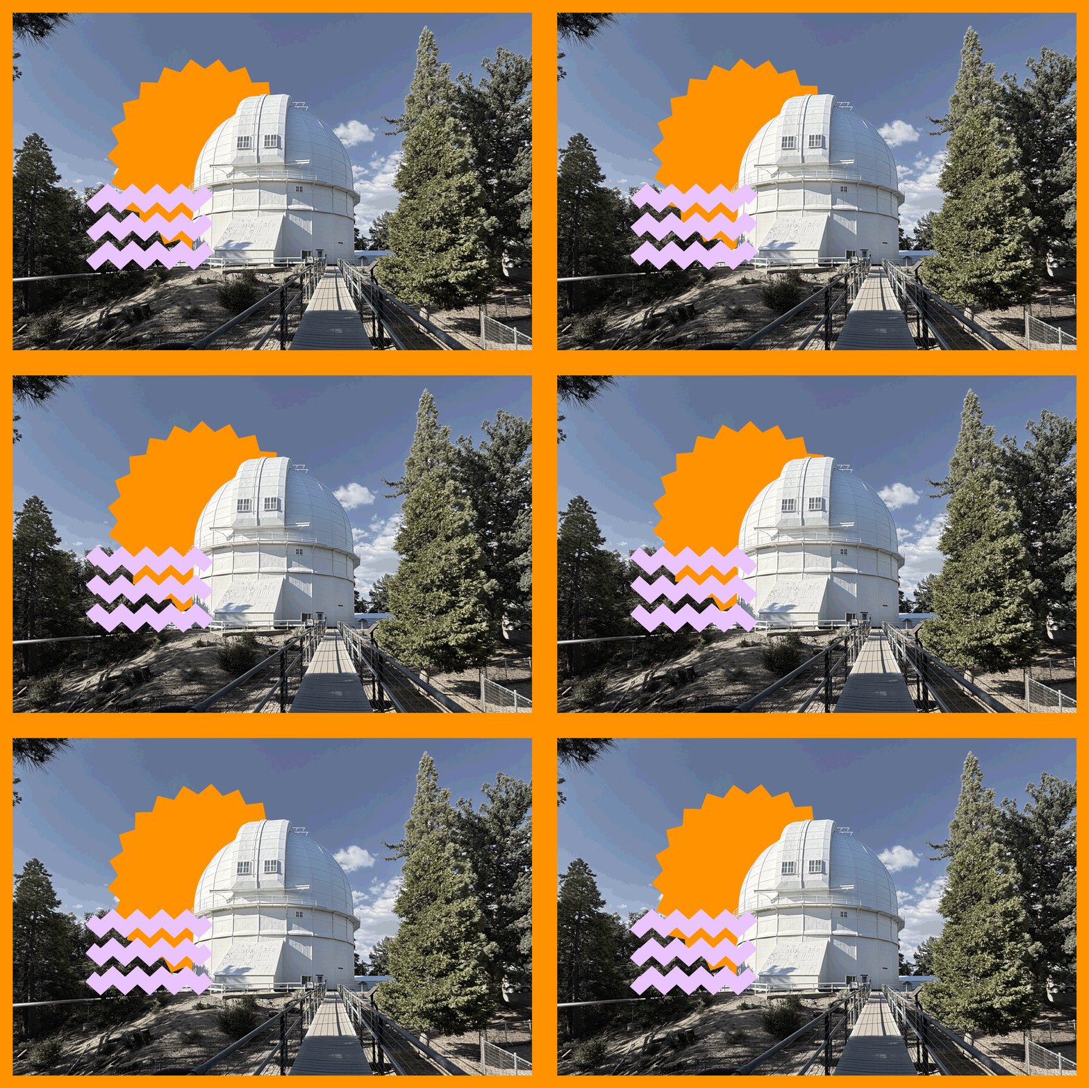
While we await Europa’s launch date, I’ve put together a round up of three hikes at and around the Mt. Wilson Observatory, which has contributed mightily to our understanding of our place in the universe, including when astronomer Edwin Hubble discovered there were far more galaxies than the Milky Way.
As Sam Hale, chairman and chief executive of the Mt. Wilson Institute and a grandson of the observatory’s founder, told The Times last year: “There’s a magic about this mountain.”
Mt. Wilson Observatory walking trail
Distance: About a mile
Elevation gain: Less than 200 feet
Difficulty: Easy
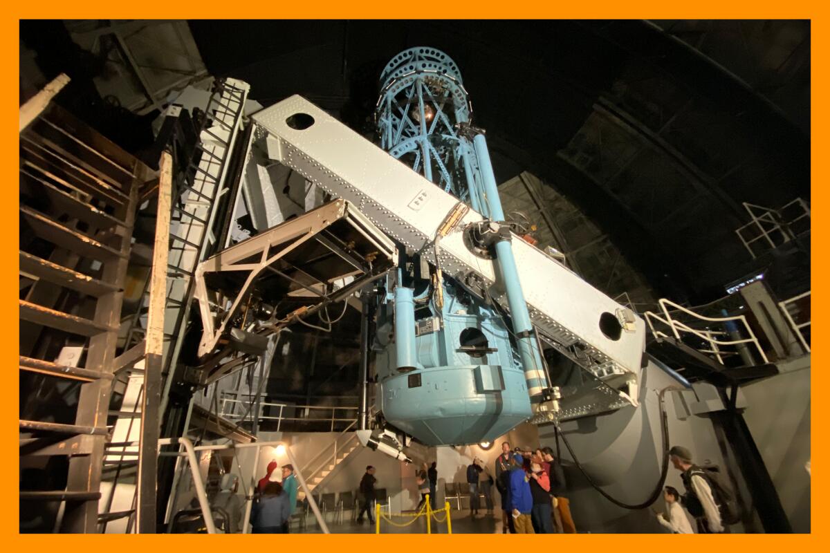
Starting at the Mt. Wilson Observatory parking lot, you can take the paved path that loops through the observatory grounds, passing its three solar telescopes. Stop along the way to read signs that expand upon the history and natural resources of the area. If able to climb stairs, you can view the 100-inch telescope gallery, open daily from 10 a.m. to 5 p.m. This is the telescope that astronomers Edwin Hubble and Milton L. Humason used to discover that our universe is expanding.
During your walk-about, you could visit both the Mt. Wilson Observatory Museum to learn of its history and the exhibit hall of the CHARA Array to discover research being conducted by Georgia State University around stars and other planetary systems.
If able to leave the paved path, I’d recommend checking out Echo Rock, which sits on the east side of the grounds. Take the dirt path to this lookout spot, where you’ll have a panoramic view of the San Gabriel Mountains and cities below. And yes, if you choose to shout, there is an echo. I checked.
The Rim Trail to Newcomb Pass
Distance: 7.2 miles round trip
Elevation gain: More than 1,600 feet
Difficulty: Moderately challenging
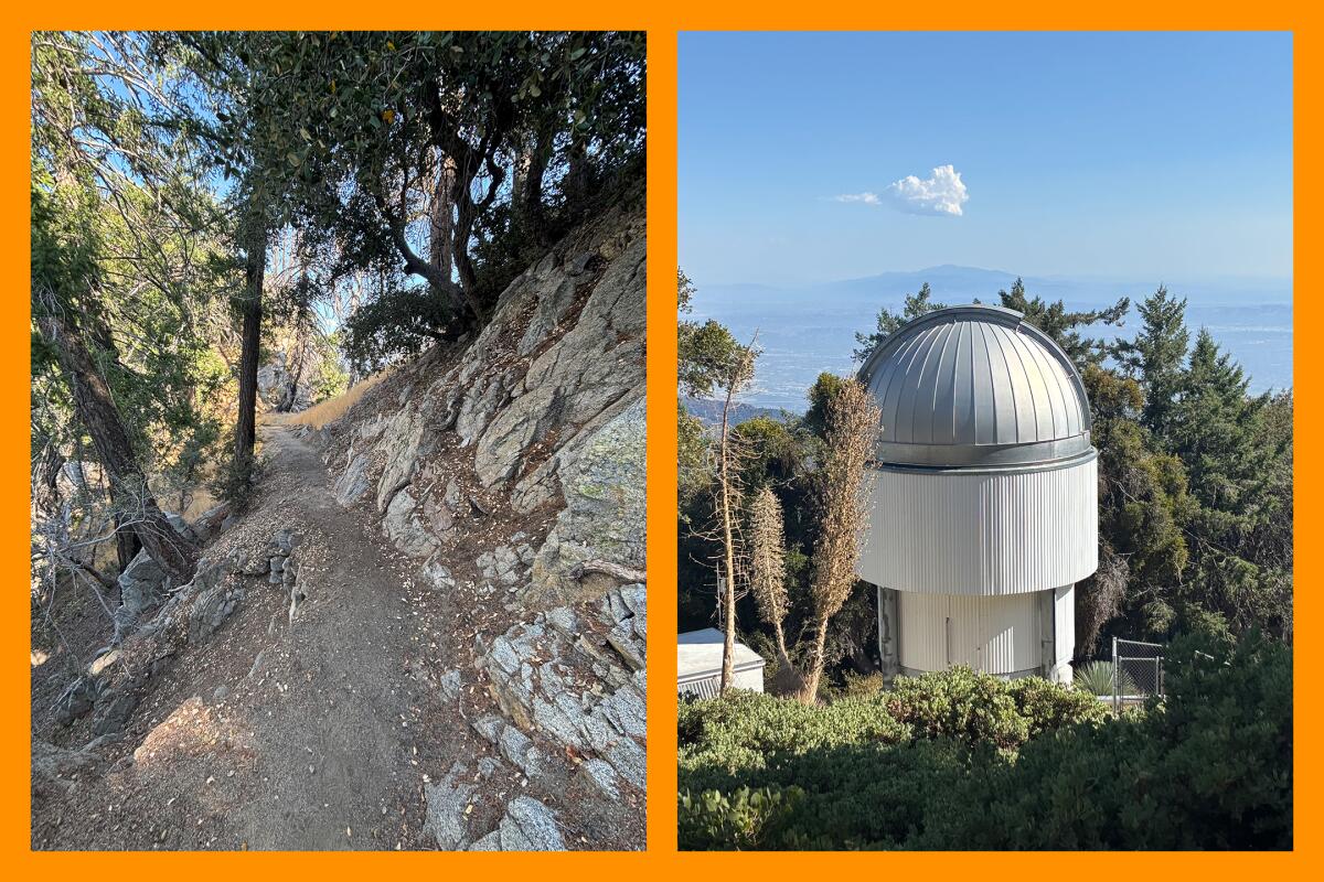
The Rim Trail, closed after the 2020 Bobcat fire, is a gorgeous, challenging jaunt that starts on the Mt. Wilson Observatory grounds and takes you through the Angeles National Forest. The Lowelifes Respectable Citizens’ Club, a nonprofit trail building crew, spent a year and a half restoring this trail to its current glory. I’m grateful for their hard work, it’s a real gem.
You will start the trail on the Mt. Wilson Observatory grounds, at the sign for the trailhead. Note: As of this writing, there was still a U.S. Forest Service sign reading “Hiking trail closed.” That is not accurate. To my readers who are rule followers: trust me, it’s open!
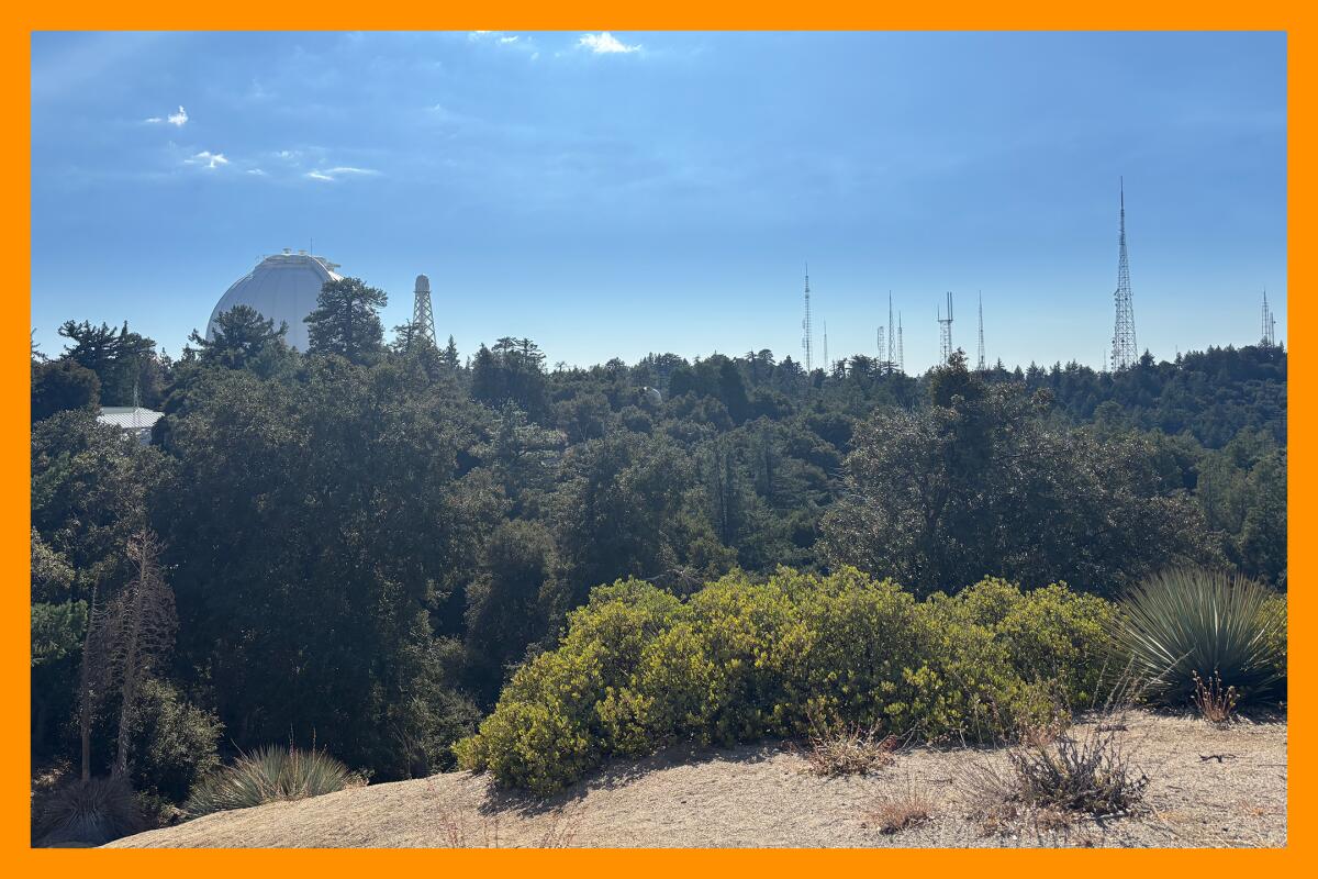
The first 0.7 of a mile is relatively easy. It begins with crunching over leaves through a meandering forest that includes sugar pine and canyon oak. Then the path snakes behind the observatory museum and past Georgia State University’s CHARA Array, an optical interferometer comprised of six telescopes that, their powers combined, form a powerful tool for contemporary astronomy.
When I visited last week, I noticed a chair atop a short hill just off the trail, probably half a mile in. I walked up to it and immediately realized why it was there: for enjoying the view of the observatory grounds to the south and a sweeping view to the north of several peaks including Mt. Baden-Powell near Wrightwood and Mt. Baldy. (It should go without saying that this is also a great selfie spot.)
If you’re up at Mt. Wilson and want a relatively easy hike, you could complete a 1.4-mile round trip of the Rim Trail, turning around just before the steep switchbacks begin. This would be a great option if you’re planning to also take a docent-led tour and want to kill some time.
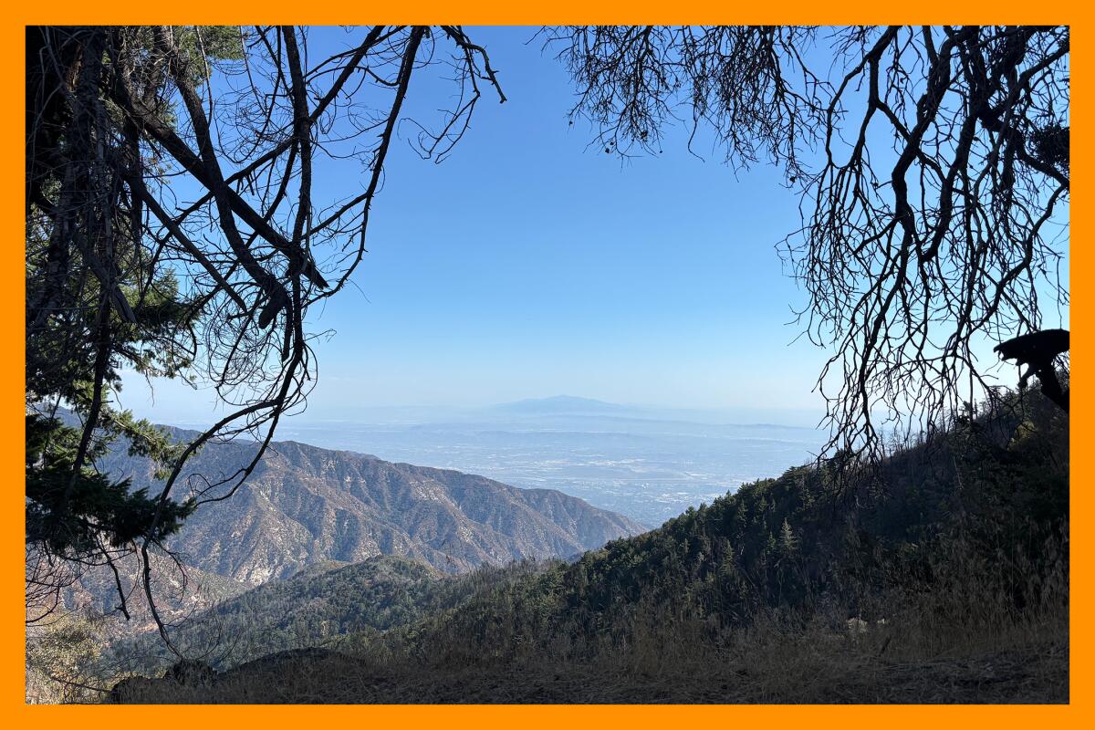
Should you want to continue, you will travel through a gorgeous forest landscape — albeit still burned in some places — down to Newcomb Pass, named after Louis Newcomb, a forest ranger and mountain man.
The hardest part of this trail is the fact that it descends about 1,600 feet over about 3.5 miles, meaning you will have to climb the 3.5 miles back up to finish. Also, there are a few spots that are very narrow but passable. That said, given the remarkable views and total solitude the Rim Trail provides, I think it’s worth it. My friend Laura and I both remarked as we hiked the path that it didn’t resemble any hike we’d done in Angeles National Forest. We paused multiple times to listen to the absolute silence on the trail and agreed we’d do it again.
Mt. Wilson Trail
Distance: About 14.5 miles
Elevation gain: Just over 5,700 feet
Difficulty: Hard
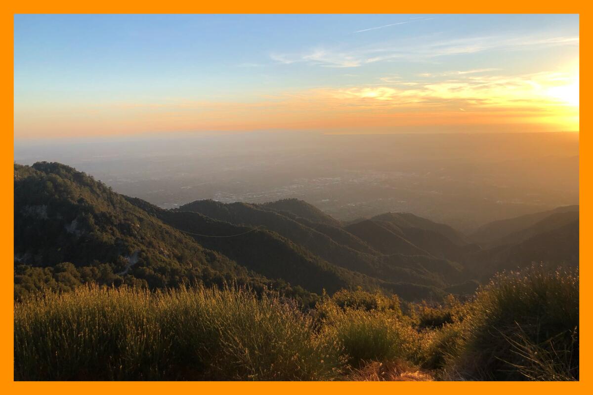
OK, so hear me out: Yes, this trail is really tough. But, after you complete it, you’ll have awesome bragging rights. Unlike other local mega-climbs (e.g. Strawberry Peak) you start on the ground, so to speak, at the Mount Wilson Trail park, in the neighborhood of Sierra Madre, and then hike the entire length of the mountain. So, later, when you’re driving along the 210 Freeway with friends, you can point to the antennas and buildings of Mt. Wilson way up high, and say “I climbed that whole mountain!”
That said, this trail has almost broken me a time or two. But, I have a love-hate-love relationship with it because the journey to the peak is so varied. It begins on an exposed path to First Water, where you can visit a seasonal stream. As you climb, you’re immediately rewarded with great views. I’ve also found this section of the trail elicits great camaraderie among hikers as everyone bonds over the suffer fest. I once met a hiker in his 60s there who does the trek every day. Another time I talked with a pregnant trail runner.
From First Water, the path connects to Orchard Camp, a shaded halfway point with ruins of the Orchard Camp resort. It was named after groves of apples, plums, cherries and chestnuts that were harvested and sold to those visiting the trail and camp in the early 1900s during the “great hiking era,” according to a historical sign at the site.
After a snack break, the trail goes up, up, up (with not much relief) until you reach Mt. Wilson, where you can refill your water bottles, grab a snack at the seasonal Cosmic Cafe and celebrate your success. Pro-tip: the Mt. Wilson Observatory is open from 10 a.m. to 5 p.m. every day outside of winter closures, so if you want to skip the descent, you could have a friend pick you up in the parking lot. (I’ve done it. No regrets!)
And, since you and your friend are both up there, might as well take the time to visit the free museum that features photographs and display panels outlining the history of Mt. Wilson.
It is best not to do this trail when it’s hot. But, as the weather cools down this month, perhaps add it to your list of outdoor challenges. After writing this, I’m certainly ready to tackle it again.

3 things to do

1. Traverse through historic neighborhoods in L.A.
Walk, ride and play your way through the heart of L.A. from 9 a.m. to 4 p.m. at CicLAvia’s 56th car-free open streets free event. Sunday’s 7.5-mile path — which is the organization’s popular signature route — connects Boyle Heights, Chinatown, downtown L.A., Echo Park, the Arts District and Little Tokyo. You can stroll over the the 6th Street bridge or past Echo Park Lake, or check out family-friendly programming at one of the event’s five hubs, walking zones along the route with restrooms and free water refill stations. Only people-powered vehicles are allowed, with exceptions for persons with disabilities. Registration is not required. Learn more at ciclavia.org.
2. Celebrate Indigenous Peoples’ Day at Mapipinga, or Vasquez Rocks
Visit the ancestral village of Mapipinga, known today as Vasquez Rocks, for its Indigenous Peoples’ Day celebration from 4:30 to 7:30 p.m. Sunday. An ethnobotany and native plant walk is scheduled for 4:30 p.m., followed by storytelling and singing by the Fernandeño Tataviam Band of Mission Indians at 5:30 p.m., and then a screening of the short documentary “Saging the World,” which explores the poaching of white sage. The event is free and will also feature animal ambassadors, local vendors, crafts, demonstrations, food trucks and s’mores. Visitors are welcome to bring a camp chair or picnic. Learn more at the park’s Instagram page.
3. Declare death to trash at Griffith Park
Haunt the trails of Griffith Park from 8:30 a.m. to noon Saturday in search of what makes all outdoors people scream: 😱 litter! At local nonprofit We Explore Earth’s “Death To Trash” event, participants will hike to Vista Viewpoint and Cedar Grove, cleaning the path along the way. Organizers will meet across the street from Franklin’s Cafe. Participants should bring what they need for a typical day hike, including at least two liters of water, and a bucket for trash (if you have it). Halloween costumes are encouraged. We Explore Earth will give away prizes from sponsors, including Liquid Death and Patagonia. Register at eventbrite.com.

The must-read
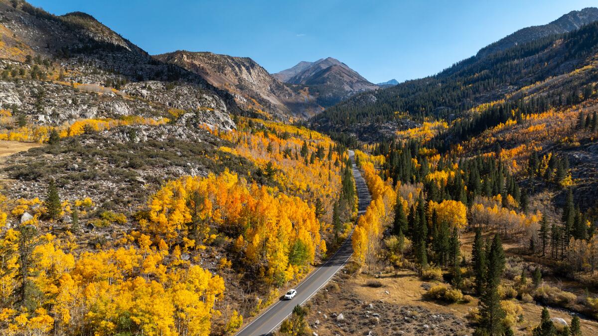
If you’re hoping to see fall in its blazing golden glory, head to the Eastern Sierra — but hurry. Times writer Jack Dolan made a stop in the Inyo National Forest near Bishop last week and caught the autumn spectacle at about 8,000 feet elevation. “At that altitude, groves of aspen and willow trees were radiant with fall color, filling creek beds and high mountain slopes with a riot of glorious hues seen once a year here and only for a week or so,” Dolan writes. He shares an easily accessible trail: Bishop Pass, which starts at South Lake. Find more leaf-peeping advice in his story — along with jaw-dropping photos by Times photographer Brian van der Brug.
Happy adventuring,

P.S.
As a friend and I were headed back home from a hike Sunday, we noticed dozens of birds flying above the freeway. That night, an estimated 291,900 birds migrated through Los Angeles County that night, a fact I gleaned from BirdCast, an academic project that tracks nighttime bird migration using weather surveillance data. Avian tourists included the red-necked phalarope, a shorebird whose breeding females feature a regal reddish throat and the bobolink, which has a yellow patch on its head resembling the bleached hair style of an early 2000s pop star. You can sign up for migration alerts for L.A and also use the site to search your city to determine how active migration will be near you. If you can, be sure to turn non-essential nighttime lighting to help our feathered friends out.
For more insider tips on Southern California’s beaches, trails and parks, check out past editions of The Wild. And to view this newsletter in your browser, click here.
Sign up for The Wild
We’ll help you find the best places to hike, bike and run, as well as the perfect silent spots for meditation and yoga.
You may occasionally receive promotional content from the Los Angeles Times.


