Slow-moving Joaquin expected to cross Bahamas beginning Wednesday
- Share via
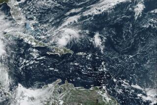
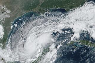
Bahamians began battening down for Hurricane Joaquin, which could bring heavy rain, pounding surf and powerful gales to large swathes of the island chain as early as Thursday morning.tmpplchld But the bigger concern remained where the still-strengthening storm would head next after an expected sharp turn to the north in the next few days. Florida, according to computer models, remained out of danger but much of the rest of the heavily populated Eastern Seaboard from South Carolina to New York will be anxiously watching Joaquin’s path through the weekend.tmpplchld The National Hurricane Center, in its 5 p.m. Wednesday advisory, shifted the long-range forecast path away from the New Jersey shore to a potential landfall as early as Sunday along the mid-Atlantic coast. But forecasters stressed that confidence that many days out remained low and it wasn’t clear yet whether Joaquin would even make landfall.tmpplchld “The range of possible outcomes is still large, and includes the possibility of a major hurricane landfall in the Carolinas,” the NHC advisory said.tmpplchld The storm was 175 miles off the central Bahamas, packing sustained winds of 85 mph. It was expected to continue to intensify, potentially reaching Category 3 strength of 115 mph by Saturday, when it would still be offshore. Hurricane winds extended 35 miles. Tropical storm force winds reached out 125 miles.tmpplchld In the Bahamas, forecasters say Joaquin could dump between five and 10 inches of rain over much of the central islands, with as much as 20 inches possible over San Salvador and Rum Cay through Friday night. Three to five inches are possible over the southeastern Bahamas through Friday, forecasters said.tmpplchld Hurricane warnings have been issued for Cat Island, the Exumas, Long Island, Rum Cay, and San Salvador, where schools were closed at noon Wednesday even as the sun continued to shine for much of the day, said Capt. Stephen Russell, director of the Bahamas National Emergency Management Agency. A hurricane watch is in effect for the Abacos, Berry Islands, Bimini,Eleuthera, Grand Bahama Island, and New Providence.tmpplchld With the storm expected to stick around until the middle of next week, the islands were bracing for possible flooding, Russell said.tmpplchld Joaquin’s impact will depend on “how the winds are blowing,” he added. “We could have some slight damages to buildings.”tmpplchld While no models show Joaquin striking Florida, differences in the computer projections make the storm’s future path less certain, forecasters said. Most shifted the path to the west Wednesday, putting the storm on track to come ashore in the mid-Atlantic region, possibly in the Carolinas. But another reliable model still shows the storm heading just west of Bermuda and out to sea.tmpplchld Forecasters said it was too early to talk about potential effects to the U.S. but much of the coastline could expect to see at least minor flooding from heavy surf as well as heavy rain. With some areas still saturated from past storms, Joaquin could also increase inland flooding threats.tmpplchld Joaquin is the first major threat to the East Coast since Superstorm Sandy in 2012, which came ashore just north of Atlantic City, ultimately caused $75 billion in damage, making it the second costliest storm in U.S. history.tmpplchld ___tmpplchld (c)2015 Miami Heraldtmpplchld Visit Miami Herald at www.miamiherald.comtmpplchld Distributed by Tribune Content Agency, LLC.tmpplchld
More to Read
Sign up for Essential California
The most important California stories and recommendations in your inbox every morning.
You may occasionally receive promotional content from the Los Angeles Times.


