Fast-moving Line fire forces evacuations in San Bernardino mountain towns

- Share via
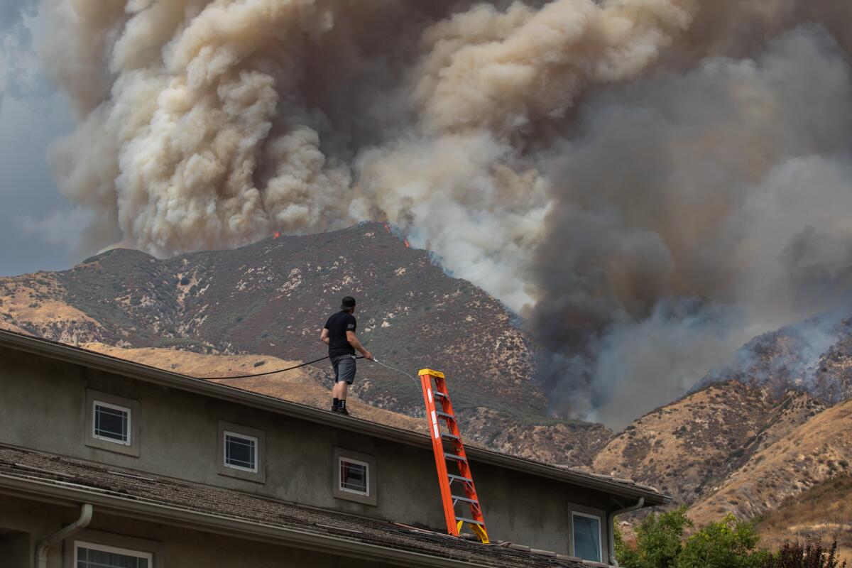
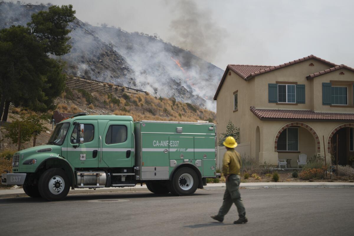
An uncontrolled wildfire in San Bernardino County doubled in size overnight, exploding to nearly 17,500 acres Sunday morning from 7,122 acres. The fire forced mandatory evacuations Saturday in mountain communities that include Running Springs and Arrowbear Lake, and prompted evacuation warnings Sunday in Lake Arrowhead, Cedar Glen, Crestline and Valley of Enchantment.
More than 35,400 structures are threatened by the fire, which is 0% contained. Three firefighters have been injured; more than 600 have been assigned to tackle the flames.
Thunderstorms and lightning Saturday suspended aircraft services and could do the same on Sunday, limiting firefighters’ ability to dump flame retardants and water on the fire, said National Weather Service meteorologist Dave Munyan with the San Diego office. By 6:30 p.m. Saturday, 282 lightning strikes were recorded in Highland and Big Bear with 3,337 other lightning flashes that stayed in the clouds, the NWS reported.
“Because they’re trying to fight the fires on some steep terrain, it’s almost impossible for them to utilize ground attack,” Munyan said.
Winds on Sunday were expected at 15 to 20 mph, and an excessive heat warning was in place for the day. Temperatures were expected to range from the upper 80s to around 100 degrees.
“The weather is definitely not cooperating for [firefighters] today,” Munyan said.
The heat wave bearing down on the Southland was not expected to break until Tuesday, with an excessive heat warning in effect until Monday night. Los Angeles County and surrounding areas were under a red flag warning as temperatures were expected to surpass 100 degrees in some parts. The combination of high heat and humidity brought a chance of thunderstorms across the mountains of Los Angeles, San Bernardino and Ventura counties, and the Antelope and San Gabriel valleys.
On Saturday, firefighters were using hand lines, hoses and fixed-wing aircraft to fight the fire, which started Thursday evening and grew rapidly that night as temperatures climbed to 110 degrees.
The fire leaped from 3,800 acres early Saturday in the city of Highland to 7,122 acres by the evening as it spread northeast into the San Bernardino Mountains toward Running Springs and Arrowbear Lake.
Track wildfire origins, perimeters and air pollution with the L.A. Times California wildfires map.
Gov. Gavin Newsom proclaimed a state of emergency in San Bernardino County on Saturday night and announced that federal funds would help reimburse the cost of suppressing the fire.
“I thank President Biden for his swift approval of support for the work of our firefighters and first responders battling this fire and protecting local communities,” Newsom said in a statement. “It’s critical that residents in the impacted areas remain vigilant and prepare to evacuate immediately if called for by local authorities.”
The National Weather Service Los Angeles said Saturday weather conditions were exacerbating the Line fire into a “dangerous situation.” Outflow winds from pyrocumulonimbus clouds — thunderstorms that form above sources of intense heat, such as wildfires — were pushing the flames around, the weather service said in a post on the social platform X.

“It’s burning out of control,” said David Cruz, spokesman for the San Bernardino National Forest.
Running Springs, a community of about 4,600 residents, is a major gateway to the popular tourist destinations of Lake Arrowhead and Big Bear. About 735 people live in Arrowbear Lake. On Saturday, residents jammed exit routes as they scrambled to comply with mandatory evacuation orders issued by the San Bernardino County Sheriff’s Department. Images from a live video feed posted on social media showed a long line of cars slowly moving down a single mountain lane.
“There’s a giant traffic jam,” Cruz said.
The so-called front route to Big Bear Lake — Highway 330 from Highland to Running Springs, and Highway 18 between Running Springs and the Big Bear Lake dam — is closed. The two back routes, Highway 18 from Victorville and Highway 38 from Redlands, are open.
A few more days of dangerous heat are forecast across much of California. But a shift in weather patterns could slightly lower temperatures by midweek.

Other areas under evacuation orders, which are issued when conditions are immediately dangerous and life-threatening, include:
- The area from Calle Del Rio to Highway 38, including Greenspot Road North.
- All underdeveloped land east of Highway 330 to Summertrail Place and north of Highland Avenue.
- The areas of Running Springs east of Highway 330 and south of Highway 18.
- The area east of Orchard Road to Cloverhill Drive from Highland Avenue north to the foothills.
More to Read
Sign up for Essential California
The most important California stories and recommendations in your inbox every morning.
You may occasionally receive promotional content from the Los Angeles Times.


