El Niño is getting stronger, and odds are tilting toward another wet winter for California
- Share via
On the heels of a record-setting wet and warm August, forecasters on Thursday announced that El Niño is gaining strength and will almost certainly persist into 2024.
El Niño, the warm phase of the El Niño-La Niña Southern Oscillation pattern, is a major driver of weather worldwide and is often associated with hotter global temperatures and wetter conditions in California.
The system arrived in June and has been steadily gaining strength, with a 95% chance that it will persist into at least the first three months of 2024, according to the National Oceanic and Atmospheric Administration. The odds of the system becoming a “strong” El Niño have increased to 71%.
That could result in a soggy January, February and March in Central and Southern California, said Daniel Swain, a climate scientist with UCLA.
“Right now, if you had to put money on it, the good money would probably be on a significantly wetter-than-average second half to winter in particular,” Swain said during a briefing Thursday, noting that those months are already the wettest time of year in Central and Southern California.
Global surface temperatures last month were 2.25 degrees above the 20th century average of 60.1 degrees, surpassing the record set in August 2016.
However, the odds of that occurring currently range from 40% to 60%, he said, so it is far from a guarantee.
NOAA officials shared a similarly inconclusive outlook for the Golden State. The strong El Niño will be meeting with long-term drying trends and anomalously warm ocean temperatures driven by climate change, making its outcome increasingly difficult to predict.
Forecasts currently show equal chances of wetter- or drier-than-normal conditions between October and December in most of California, said Scott Handel, a meteorologist with NOAA’s Climate Prediction Center.
But “given the strong El Niño event likely to occur this winter, we are leaning toward above-normal precipitation, slightly, for the Los Angeles area this winter,” he said.
Adding to the uncertainty is characteristic variation among El Niño events, with no two playing out the same way.
“It is never a guarantee,” said Jan Null, a meteorologist with Golden Gate Weather Services. “The best case study is last year with a La Niña, and all the models calling for below-normal precipitation. That was not what happened.”
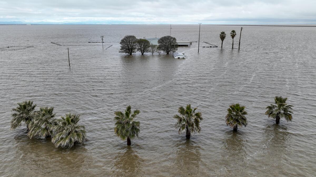
This La Niña winter was among the wettest in recent memory, with more than 30 atmospheric rivers pummeling California, causing devastating levee breaches, fatal flooding and the resurgence of Tulare Lake.
Null said data from previous El Niño events also demonstrate its unpredictability. A strong El Niño in 1957-58 resulted in above-average precipitation across California, as did very strong El Niños in 1982-83 and 1997-98.
But the most recent very strong El Niño in 2015-16 was relatively dry in California, resulting in just 86% of normal precipitation in the South Coast region that includes Los Angeles, Null said.
“I would not put any money on a long-range forecast — there are too many other things that could change the outcome,” he said.
That includes lesser-known patterns that can also affect weather behavior, such as the Madden-Julian Oscillation, the Pacific Decadal Oscillation and the North Atlantic Oscillation.
Null said most of the models he has reviewed point to a “dry-ish” December, a “normal-ish” January, and a February and March that are above normal for precipitation.
“All of this is overlaid with the fact that the oceans and the atmosphere are warmer,” he added. “Every weather event has some climate change DNA in it these days.”
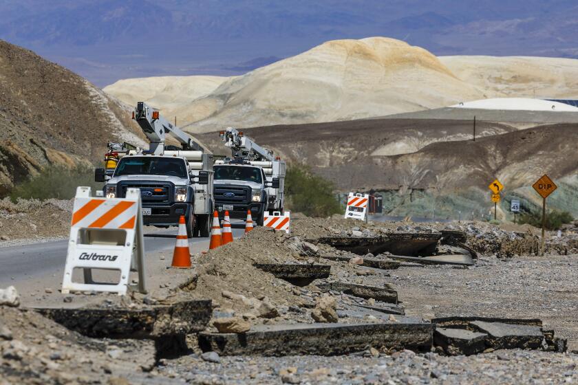
As Hilary bore down, torrents of water rushed through the park, forging new gullies, displacing heavy rocks and undercutting park roads.
Indeed, the outlook comes as NOAA officials affirm that August was Earth’s hottest month on record. The three-month period of June through August, known as meteorological summer in the Northern Hemisphere, saw record warmth as well.
Ocean temperatures also soared to new highs, including some parts of the Pacific and Atlantic basins that are as much as 10 degrees above normal, Swain said. The ocean temperatures are so anomalously high that it is hard to be certain how El Niño will interact with them.
“El Niño, right now, is not the only game in town,” Swain said. “What we’ve never seen before is a strong El Niño event of this magnitude combined with record-breaking ocean temperatures in so many other places concurrently. That is a pretty different situation.”
Though the unique conditions have left forecasters in “a little bit of limbo,” Swain said it would still be wise to prepare for another wet winter in Central and Southern California, as the odds are tilted toward that outcome.
“The implications of having another [wet winter] consecutively are greater,” Swain said. “Right now we’re not so worried about water scarcity in California, but we’re probably more concerned about the potential for faster and more intense runoff from winter storms because things never fully dried out from last year.”
The soaking storms that started the year were later followed by Tropical Storm Hilary, which dropped considerable rain when it barreled through the state in August.
Some California regions received roughly 5 inches of rainfall over a two-day period from Hilary — including parts of Los Angeles, Kern and San Bernardino counties, said Brett Whitin, service coordination hydrologist with the California Nevada River Forecast Center.
Some desert areas saw rainfall totals of 150% of their entire annual average during the storm, Whitin said.
The extreme precipitation events that have marked 2023, he added, are a good demonstration of “the wild ride we’ve had in California this year.”
More to Read
Sign up for Essential California
The most important California stories and recommendations in your inbox every morning.
You may occasionally receive promotional content from the Los Angeles Times.
