California’s heat wave fueling destructive fires. The worst is yet to come, officials fear
- Share via
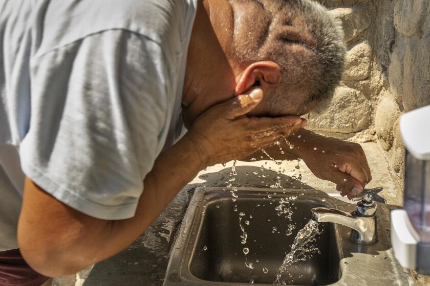
SACRAMENTO — More than a week of record-setting heat across California is fueling several destructive wildfires and worsening already critical conditions ahead of the fall fire season.
Officials were bracing for an intense fire season because of California’s drought conditions. But experts say the heat wave — likely to be the longest and hottest on record for September — is setting the stage for fires to spread much faster.
The scorching temperatures have created a “flash drying effect” by pulling out all the moisture from trees, grasses and other vegetation, according to Brent Wachter, a meteorologist at the U.S. Forest Service’s Geographic Coordination Center.
“We’ve had really low humidity and warm temperatures, not just during the daytime but through the entire 24-hour period, and it’s created increased flammability in the fields and bumped it into an ultra-flammable scenario,” he said.
After more than a week of statewide Flex Alerts, Thursday’s alert lasted two hours longer because solar energy supplies could be stunted.
In the Sacramento Valley foothills, moisture levels for dead fuels have dipped to their lowest in about 25 to 30 years, according to Wachter.
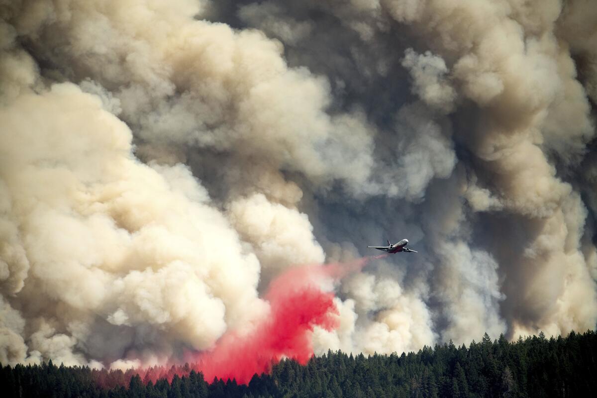
That is the area where the Mosquito fire doubled in size to more than 13,700 acres Thursday after sparking two days earlier near Foresthill in Placer County, provoking a mandatory evacuation order for about 2,500 people, according to the California Department of Forestry and Fire Protection. More than 1,000 structures were threatened and some homes have been burned down, but officials didn’t have an exact count Thursday.
By Thursday afternoon, the fire had raised a giant pyrocumulus cloud, jumped the Middle Fork of the American River and was burning its way toward the hamlet of Volcanoville in El Dorado County.
“It’s very hot. It’s dry, and it’s burning into areas where there are people,” said public information officer Chris Vestal. “The No. 1 priority is to get people out of their homes and out of the area.”
The cause of the fire is under investigation, but Pacific Gas & Electric Co. filed a report disclosing “electrical activity” at one of its transmission lines near where the fire started Tuesday night. The blaze had no containment as of Thursday. Evacuation centers have been set up at the Bell Road Baptist Church in Auburn and the Cool Community Church in Cool.
“A big part of this is during the overnight hours, usually fires lay down, but they keep on trucking during a heat wave and are very active overnight,” Wachter said. “That’s the key difference in what makes this period so unusual.”
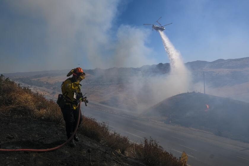
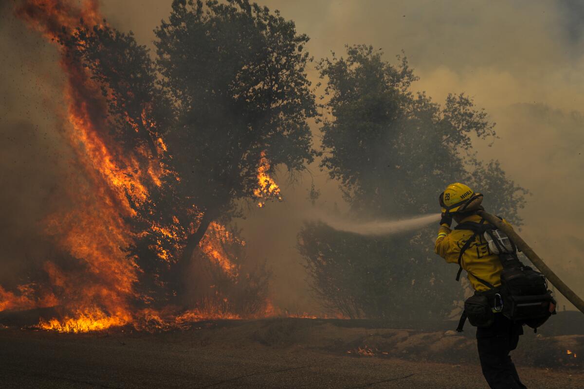
Southern California is contending with the Fairview fire, which ballooned to nearly 24,000 acres with 5% containment as of Thursday evening and has prompted officials to expand evacuation orders and issue increasingly dire warnings.
“I have not seen a fire burn like this in Riverside County in my career,” said John Crater, Temecula division chief for Cal Fire. “It’s a very stubborn fire. It’s doing things that we just haven’t seen.”
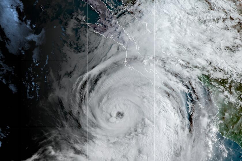
Officials expect to evacuate 22,000 people from the area, Crater said, as forecasters warned that Tropical Storm Kay could bring winds of more than 50 mph to the fire zone. High winds combined with drought-stricken fuels could mean further explosive, unpredictable growth, and rain could bring the risk of mudflows.
Gov. Gavin Newsom proclaimed a state of emergency Thursday for Riverside, El Dorado and Placer counties due to the Fairview and Mosquito fires.
Wildfire activity has also been intensified by the compounding effects of climate change, which have made fires larger, more disastrous and burn for longer periods of time, according to UC Merced fire scientist Crystal Kolden, a former firefighter with the U.S. Forest Service.
Whereas a heat wave of this length and magnitude would typically occur in July in previous years, Kolden said it’s significant that the current one hit between late August and September.
“To have a heat wave like this occurring in September is unusually late, especially with these high temperatures, and it’s really problematic for fires because it’s drier now across the state than it was in July when we’d normally see the hottest temperatures of the year,” she said.
Although Northern California usually starts to cool down and see precipitation earlier than Southern California during the fall, Kolden said climate change has made the prospect of a year-round fire season more of a reality in some parts of the state.
“NorCal has a summer fire regime and we see that peter out in September, and this heat wave means that NorCal is still really going strong,” she said. “It’s a demonstration that climate change is making fire seasons much longer and making it so those resources that are already stretched thin are having to go over longer periods of time, well into the fall.”
Meanwhile, Southern California’s peak fire season usually begins in October and coincides with the arrival of the Santa Ana winds. But if the region doesn’t get enough rain during the October-to-September water year, those fires could persist into the winter.
“In recent years, we’ve seen Santa Ana fires in November and even in December, which again is an impact of climate change,” Kolden said.
Although this fire season hasn’t been particularly severe compared with previous years, Kolden said because of climate change, even relatively tame wildfires are becoming more deadly.
Extreme dryness, soaring temperatures and frequent wildfires are increasing the risk for fire crews — and it will likely get worse in years to come.
“Decades ago, this would’ve felt like a really minor season given the number of ignitions and we haven’t had a massive lightening event that started a bunch of fires,” she said. “This has been a quieter year but the fires that started have been destructive and fatal. Climate change is altering fires across the season.”
At least nine people have lost their lives due to wildfires so far this season, including two killed in the Fairview fire and four killed in the McKinney fire, which sparked in the Klamath National Forest near California’s border with Oregon in July and burned more than 60,000 acres.
John Schulz, who lives four miles from the Fairview fire, said his power went out and it was about 97 degrees inside on Monday. Schulz, who previously lived in Paradise and Quincy, witnessed the 2018 Camp fire.
“It’s the same thing: heat and dry conditions creating perfect situations for fires,” he said. “This will be my last summer in California.”
Temperatures are expected to be in the 90s in most of Southern California on Friday and in the 100s all the way from Long Beach to downtown Los Angeles and around Beverly Hills, according to National Weather Service forecaster Carol Smith.
Two records for the date were broken Thursday at Los Angeles International Airport and in Paso Robles. It was 97 degrees at LAX, surpassing its previous record of 93 degrees set in 1984. It was 108 at Paso Robles, eclipsing its record of 106 degrees set in 2021.
Residents should expect to battle the heat until Friday evening, although Smith said the heat warning might be extended due to the “unusually high” overnight temperatures that have reached into the 80s.
“We’re in a drought and it’s been really hot during the extended heat wave,” she said. “Vegetation is really dry. The excessive heat gives higher chances of the fire start being plume-dominated, which means it’ll grow very rapidly with extreme fire behavior.”
The heat wave is expected to subside by this weekend, coinciding with Tropical Storm Kay, a storm system off the coast of Mexico that is expected to affect the state in the coming days. Rain is forecast for portions of L.A. County on Friday and is expected to reach Northern California by Saturday.
Can a hurricane in Mexico bring relief to SoCal heat wave? It’s expected to bring plenty of moisture
Hurricane Kay, a system off Mexico’s Baja California Peninsula, could bring humidity, flash floods, high winds and strong surf to Southern California.
Wachter said the storm system could “have two storylines” in that the moisture push, thicker cloud cover and higher humidity could help quell fire activity. On the other hand, downdrafts from the storm could form over the wildfires and “make it spread in erratic ways,” he said.
Officials are preparing for potential flooding during the storm near burn scars, Cal Fire spokesperson Jon Heggie said.
“It’s a very unique situation to have a major wildland fire burning right now as we speak and to be impacted by the remnants of a hurricane,” he said. “We could be fighting the fire one hour and preparing for floods the next.”
Lin reported from Los Angeles and Garrison from Sacramento. Times staff writer Gregory Yee contributed to this report.
More to Read
Sign up for Essential California
The most important California stories and recommendations in your inbox every morning.
You may occasionally receive promotional content from the Los Angeles Times.
