Strong winds possible in the San Gabriel Valley area Sunday morning, forecasters say

- Share via
There is a potential for a brief period of strong, gusty north winds in the San Gabriel Valley foothill and valley communities early Sunday morning, the National Weather Service said.
Unusually gusty winds of 40 to 50 mph are possible from about 4 to 10 a.m. Sunday, with a period of peak gusts lasting one to three hours. Winds gusting to 65 mph cannot be ruled out.
Some areas likely to be affected are La Cañada Flintridge, Altadena, Pasadena, Temple City, Arcadia, Azusa, Monrovia, Duarte, Glendora and San Dimas, the weather service said.
North winds such as these are fairly rare, and they are generated by a weather pattern that is difficult to predict. “There are many ingredients that have to line up,” said Eric Boldt, a meteorologist with the weather service in Oxnard.
These winds are expected to be weaker than the damaging winds in December 2011, but downed trees and power outages are still a possibility. There also will be brief elevated to critical fire weather conditions as relative humidity readings dip to the 5% to 15% range by Sunday afternoon.
In addition to the 2011 event, Boldt said there were similar windstorms in 1988 and 1997. In all of these cases, north winds blew through areas that are not typically prone to such winds.
The winds need to come from a northerly direction, about 30 degrees on either side of a straight north-south line, for this type of event to occur, and that makes them difficult to predict, Boldt explained.

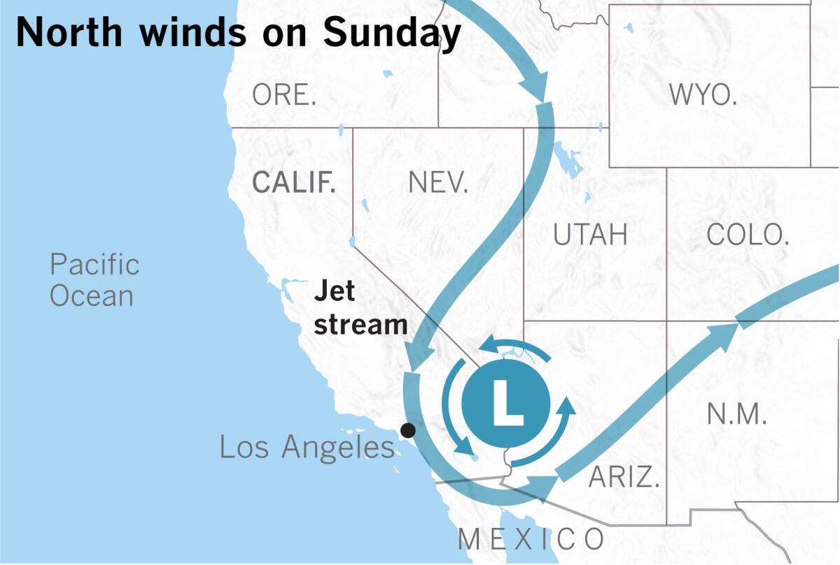
The key ingredient to the setup is a rapidly deepening low-pressure system that will be centered over western Arizona at about 7 a.m. Sunday. Winds blow counterclockwise around the low. These winds could align with and be supported by the jet stream, which is high above, at about 30,000 feet. Such a pattern can enhance the winds at the surface and provide plenty of cold, dry air.
Another ingredient is when these robust northerly winds encounter the San Gabriel Mountains, a part of Southern California’s Transverse Ranges. The mountains rise abruptly and line up west to east, creating an almost exactly perpendicular obstacle to the winds.
As with northeasterly Santa Ana winds, north winds must find a way up and over or through the mountains. They funnel through passes and canyons, then speed up as they descend into the L.A. Basin. Because the air is cold, it’s dense, so gravity also accelerates the winds as they hurl down the lee side, or south side, of the mountains.
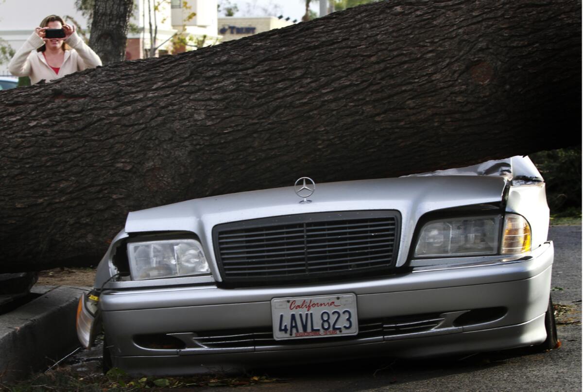
Winds of about 50 mph usually lead to tree damage, Boldt said. Falling tree limbs can bring down power lines. Temporary outdoor structures such as tents and other loose items can potentially be damaged or tossed around.
More to Read
Sign up for Essential California
The most important California stories and recommendations in your inbox every morning.
You may occasionally receive promotional content from the Los Angeles Times.


