Less Snowfall Could Spell Big Problems for State
- Share via
SACRAMENTO — New scientific research suggests that global warming, even by what experts consider conservative estimates, will severely shrink the Sierra snowpack, which is crucial to sustaining California’s economy and population.
Within a lifetime, Californians will begin to see a shift in precipitation that will bring less snow and more rain to the mountains, say scientists at the Scripps Institution of Oceanography in La Jolla. They recently calculated the effect of an atmospheric increase of 2 to 4 degrees Celsius in the next 60 years--a rate of global warming that many experts consider highly likely.
Those findings amplify a significant body of evidence regarding global warming and its implications for California. Concerned about the findings, experts intend to convene this month in Los Angeles to discuss the research and possible responses.
Although the temperature increase may seem small, the implications of such a shift in the timing and form of precipitation are monumental. Indeed, some scientists and others worry that they could be disastrous in a state that has invested billions of dollars in dams and aqueducts to capture the annual melt of the Sierra Nevada snowpack.
The snowpack acts as a regulator, holding water through the winter in the form of snow and then gradually releasing it through the spring and summer. Water that falls as rain instead of snow flows directly into the state’s water-control system, with much more immediate consequences.
Experts say that in California, even marginally higher temperatures could lead to greater flooding, an overall decline in water supplies, a decrease in summer hydroelectric power production and a wholesale disruption of the plants and animals of the 400-mile-long Sierra Nevada, the Cascades in Northern California and the rivers that spring from their snowfields.
And though some scientists believe the state’s system of dams, aqueducts and the like can handle the climate change, others warn of potentially dire consequences.
“This whole state clings to the Sierra Nevada,” said Jeffrey Mount, chairman of the geology department at UC Davis. “The health of the Sierra Nevada, the hydrology of the Sierra Nevada, is everything to California. I don’t think you can overstate that.”
The Scripps research is based on two models of how worldwide warming could affect the United States. Although the mainstream scientific community agrees that such warming is underway, the causes are still being debated and the regional effects are difficult to predict.
“In the big picture, warming means less snow, less ice,” said Lonnie G. Thompson, an Ohio State University professor of geological sciences. “But what happens in a particular place on Earth is less certain.”
Since the mid-1980s, scientists have warned that climate change could cripple California’s water system, which is one of the most highly engineered in the world.
What is new about the Scripps research is the level of detail. It shows the expected change in the water content of the snowpack for each 4-square-kilometer section of the mountain range. In many sections, especially at lower elevation, the snowpack would shrink 80% or more.
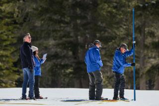
“The snowpack acts like a big natural reservoir,” said Noah Knowles, the Scripps researcher who used information from mountain weather stations and the state’s annual snowpack surveys to track the effect of a warming trend. “If you lose that, management-wise, it’s like losing reservoir storage space.”
Water Policy Officials Express Concern
His fellow researcher, Michael Dettinger of the U.S. Geological Survey, said a vastly shrunk snowpack by 2060 is “absolutely not outlandish.”
“This could happen in our lifetimes, certainly in our kids’,” he said. “If the temperatures go up, there’s hardly any other way it could work.”
The new research has aroused California’s water policy officials to begin planning for global warming. The state Department of Water Resources has arranged a meeting for June 20 in Los Angeles, where researchers will describe their findings to a 60-member panel of advisors helping to craft the state’s next water plan, due in 2003. Such plans have been published every five years since 1957. None has yet addressed climate change.
“We will be looking seriously at how we make decisions, now recognizing the possibility that climate change may be occurring,” said Jonas Minton, deputy director of the Department of Water Resources. “It will not be as simple as just building new reservoirs for water supply and flood control. The best dam sites have already been used. Although some new dams may be built, they would not by themselves be able to mitigate all the impacts.”
Implications of global warming, he said, stretch from governmental approval of new development in flood plains to the state’s multibillion-dollar effort to restore salmon and other endangered species in the Sacramento-San Joaquin Delta.
The surface temperature of the Earth has risen an estimated half a degree Celsius in the last century, and many scientists believe the cause is the buildup in the atmosphere of gases generated by human action such as the burning of gas, oil and coal. These “greenhouse” gases, such as carbon dioxide, trap the sun’s energy and increase surface temperatures.
In a September 2000 national assessment of the potential consequences of climate change, the U.S. Geological Survey concluded that mountainous areas are especially vulnerable.
The Sierra Nevada, more than 14,000 feet high at some peaks, wrings rain and snow from storms moving east off the Pacific Ocean. The rivers that drain from the range supply 20 million people and irrigate 4 million acres of farmland. The range is California’s chief source of surface water.
Sierra mountaintops are so cold as to be immune to a slight warming of the Earth’s average temperature, scientists say. But in the middle and lower elevations, a warmer atmosphere would lead to more rain and less snow.
Rain runs off immediately, which would heighten the risk of floods in the Sacramento and San Joaquin valleys. Major rivers that begin in the Sierra would also run higher in the winter, making them more dangerous.
Massive System Depends on Snow
Just as important, those rivers would run more weakly in the late spring because there would be less snow melting.
That could throw off the massive system California has invented to defy nature.
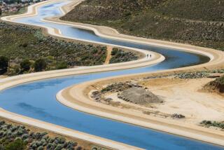
That system--which makes it possible for California to sustain 34 million people and some of the world’s richest irrigated farmland--is built around a vast collection of dams and aqueducts. In the northern part of the state, dams capture rainfall, and pumps and canals carry the water hundreds of miles to the south, where most of the population lives.
That grand web also protects against the state’s natural extremes. Droughts in California can stretch seven years and longer, only to be followed by severe flooding. Reservoirs serve as a hedge.
California’s biggest reservoirs, such as Shasta and Oroville, are operated for both flood control and water supply. Kept low in the winter, they help stop floods. But as the likelihood of big storms declines in April, the reservoirs are allowed to fill with snowmelt.
Replenished by snowmelt, the reservoirs’ water levels are slowly lowered again through the arid summer and fall to sustain farms and cities.
Under the regimen described by the Scripps researchers, dam operators would have to keep reservoirs lower in the winter to protect against overflow during heavy rains. And there would be less chance of the reservoir refilling in the spring, because so much of the season’s precipitation would have already fallen as rain, not snow.
“The same amount of water tends to come down,” Dettinger said. “But it all is coming down now in a period where we manage it as a hazard and try to get rid of it as quickly as possible.”
The Scripps researchers say it’s difficult to determine whether global warming is already changing California’s waterscape.
But one of the first scientists to analyze the potential effect of climate change on California’s water supplies said he believes there is such evidence.
Peter Gleick began studying climate change in the mid-1980s and continues to do so as president of the Pacific Institute for Studies in Development, Environment and Security in Oakland. He sees a warning in the declining springtime flows of the Sacramento and San Joaquin rivers.
Records between 1906 and 1997 show a shrinking volume of water flowing down those rivers between April and July as a percentage of the annual runoff. Gleick sees that as early evidence of the reduced snowfall and earlier runoff scenario the Scripps researchers predict.
More Efficiency Could Help State Cope
With smart management, he said, the state can live with the greater flood risk. And more efficient use of water can help cope with any loss in overall supply, Gleick said.
Mount said California water officials have been slow to wake to the implications of global warming. He said that includes the state Reclamation Board, to which he was appointed by Gov. Gray Davis. The board oversees development in the state’s floodways.
“The future is not going to be anything like the past,” Mount said. Yet California’s first line of defense against flooding, the designation of “100-year” flood plains where development is supposed to be restricted, is based on historical records of stream flow that climate change may render meaningless.
“Not once do I ever hear, ‘We need to build in much larger margins of safety here because we think the climate may change,’ ” Mount said. “The decisions I’m making today on the Reclamation Board are totally inadequate in many ways.”
More to Read
Sign up for Essential California
The most important California stories and recommendations in your inbox every morning.
You may occasionally receive promotional content from the Los Angeles Times.


