Walnut Creek: Oasis in the San Gabriel Valley
- Share via
Walnut Creek is really a creek. No cement channel to contain it. It runs even during drought years. You might even get your feet wet crossing it.
Sure, it eventually meets the fate of all county waterways and becomes incarcerated by various flood-control works, but for more than two miles, through Walnut Creek Regional County Park, the creek runs free.
On the map, Walnut Creek County Regional Park appears as a green worm wriggling through a suburbanized corner of the San Jose Hills. On the ground, the long, narrow park seems even more removed from its civic surroundings than is indicated on the map.
The two-mile trail through the back country of San Dimas and Covina can be enjoyed in a couple of different ways. You can walk it one way and use a car shuttle, or make it a four-mile out-and-back trek.
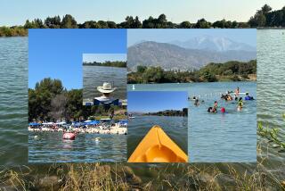
Another option for hikers is to join trails in adjacent Frank G. Bonelli County Park. Fourteen miles of trails cross the park’s chaparral-covered hills, lead through quiet canyons shaded by oak and walnut groves, and circle the park’s main feature--Puddingstone Reservoir.
Plantations of pepper, eucalyptus, cedar and pine have been planted in the park. Wildlife includes squirrels, cottontail rabbits, blacktail rabbits, raccoons and deer.
Trails and trail junctions are rarely marked, but the paths don’t stray too far from park roads and landmarks, so you won’t get lost.
Add a six-mile loop around the reservoir to the four miles round trip along Walnut Creek and you’ll have a 10-mile hike through some greenery that might surprise you--considering that it’s in the heart of the San Gabriel Valley.
Directions to trail head: You can reach the lower trail head in Walnut Creek Regional County Park by exiting the Foothill Freeway (210) on Covina Boulevard.
Head west to Valley Center Avenue, turn left and proceed to Cypress Street, where you turn right. At Lyman Avenue, make a left. When you reach Scarborough Road, turn left and park in the dirt lot.
The upper trail head is easier to reach. Exit the Foothill Freeway on San Dimas Avenue. Head south a short ways, passing under the freeway overpass and park on the avenue’s shoulder on your right. Signed Walnut Creek Trail begins there.
The hike (from the lower trailhead): The wide trail begins a gentle creekside ascent under the shade of live oak and the California black walnut that gave this creek, canyon and park their names.
You’ll soon make the first of your half a dozen creek crossings en route. After about a mile, you pass through an equestrian parking area in a grove of eucalyptus trees and cross the paved road leading to Pacific Coast Baptist College.
As you ascend, the canyon seems to narrow, isolating you from the busy world beyond. After crossing a bridge and the creek a couple more times, the trail rises out of the tranquil canyon toward the noisy freeway and San Dimas Avenue. You can either return the same way or cross San Dimas Avenue and enter Bonelli County Park.
Where: Walnut Creek Regional County Park Distance: 2 miles one way with a 500-foot elevation gain possible. Terrain: Creekbed, gentle San Jose Hills. Degree of Difficulty: Easy to moderate. Highlights: Usually dependable creek, welcome green in the suburban scene. Precautions: Very muddy after a heavy rain. For more information: Contact Bonelli County Park, 120 E. Via Verde, San Dimas 91773, (714) 599-8411
More to Read
Sign up for The Wild
We’ll help you find the best places to hike, bike and run, as well as the perfect silent spots for meditation and yoga.
You may occasionally receive promotional content from the Los Angeles Times.


